

Hello guys!
Welcome to my suggestion of reworking, perfecting Northern Europe")
As the feedbacks are looking positive, i will try to polish this suggestion, so when the time comes we will have a nice rework for the region.
Table of contents:
I. Map changes:
1. Scotland

While Scotland got a buff recently, it still feels lacking. England usually easily conquer it until 1500 in one or two wars. So i propose to give more strength and detail to the lowland parts, by dividing it into Central Lowlands and Aberdeen states.
New provinces (capital): trade good, terrain
Moray (Elgin): fish, highland <--- North of Aberdeen.
Angus/Forfar (Dundee): wool/cloth, farmland/highland <---South of Aberdeen.
Lanark (Glasgow): iron, farmland <---Between Lothian and Ayrshire, so you can't move directly between them.
Fife (St. Andrews): livestock, grassland <--- Small, yet important.
Durham (Durham): iron/grain?, grassland <--- South of Northumbria, not part of it.
Minor corrections:
-Put the island of Bute to Argyll province, as it's not even part of the Hebrides.
-Norway could have some missions, regarding the Isles, as it was colonised by them and ruled until 1266.
-Move the CoT from Ayrshire to Lanark (Maybe also the coal, as it was mined in both places, see sources).
-Change the terrain of Argyll, Perth and Aberdeen to Highland from Hills, Change Inverness to Mountains from Highland.
-Move the coal from Northumbria to Durham.
-New Aberdeen state: Aberdeen, Moray, Angus/Forfar.
-Border fixed for Argyll, Perth, Inverness.
Sources:
http://www.scotlandsfamily.com/sct_cmap.gif
https://en.wikipedia.org/wiki/Fife
https://en.wikipedia.org/wiki/County_Palatine_of_Durham
https://en.wikipedia.org/wiki/Lanarkshire
https://en.wikipedia.org/wiki/Moray
https://en.wikipedia.org/wiki/Angus,_Scotland
https://en.wikipedia.org/wiki/Dundee
http://www.wwmm.org/immagini/z_1716.jpg
2. Scandinavia

Scandinavia is one of the best regions in the game, yet it needs a few provinces to be perfect. For example the enormous capital provinces. Besides Sweden is lacking the might to carry out it's historical role, and be a decent rival for Russia or Poland in it's own. So they would need at least a slight buff.
New provinces (capital): trade good
Buskerud (Tonsberg): fur <--- Western half of Akerhus, that was separated from it in the 17th century.
Hedemark (Kongsvinger): naval sup/fur <---- Eastern half of Opplanda.
Roskilde (Roskilde): naval supp/livestock <--- Capital of Denmark until 1443
Jönköping (Jönköping): livestock <--- Maybe a lvl1 CoT, as it was an important market town
Södermanland (Nyköping): fish/livestock <--- Southern part of current Stockholm
Uppland (Uppsala): grain <--- It was the center of the Archdiocese of Sweden
Minor changes:
-Rename the existing Tioharad province to Kronoberg, and change it's tradegood into grain (or maybe livestock)
-Rename Östergotland to Linköping, because that's the state's name.
-There could be an event for the founding of Gothenburg.
-The strait's danish end should be in Copenhagen province, not Roskilde.
-Now there's enough provinces for a decent Östra Svealand with Södermanland, Uppland, Stockholm and maybe Aland, so Bergslagen can be moved to Vastra Svealand state where it does belong.
-Sea tiles slightly redrawn to represen the Öresund better.
Sources:
https://en.wikipedia.org/wiki/Counties_of_Sweden
https://en.wikipedia.org/wiki/Jönköping
https://en.wikipedia.org/wiki/Roskilde
https://en.wikipedia.org/wiki/Buskerud
https://en.wikipedia.org/wiki/History_of_Gothenburg
3. Bothnia and Finland

While the map projection shows this area a lot larger than it is really, some provinces are still awfully big (especially Halsingland, compared to being relatively on the south). Besides, Finnish provinces with this little polish perfectly reflect the area at the time. Red dots are the capitals of the -
New provinces (capital): trade good
Angermanland (Härnösand): fish <---Northern part of current Halsingland.
Kymmenegard (Heinola/Pyttis): fish <---Carved out of Savolax, Nyland and Viborg, alternative name Kymmenedalen.
Minor changes:
-Norrland state: Västerbotten, Angermanland, and Halsingland.
-Lappland and Jokkmokk to Laponia state.
-Ostrobothnia/Österbotten state and Enare redrawn.
-Birkaland merged with the northern part of Åbo to form Björneborg/Satakunda province (Ulsby).
-Finland Proper/Western Finland state: Åland, Satakunda, Åbo.
-The new Tavastia/Central Finland state: Nyland, Tavastland, Savolax, Kymmenegard.
-The region also lacks center of trades. Potential lvl1 CoTs: Åbo, Viborg.
-There could be an event in the 17th century for Sweden for the founding the town of Vaasa in Österbotten.
Sources:
https://en.wikipedia.org/wiki/Ångermanland
https://en.wikipedia.org/wiki/Gävle
https://en.wikipedia.org/wiki/Satakunta
https://en.wikipedia.org/wiki/Turku
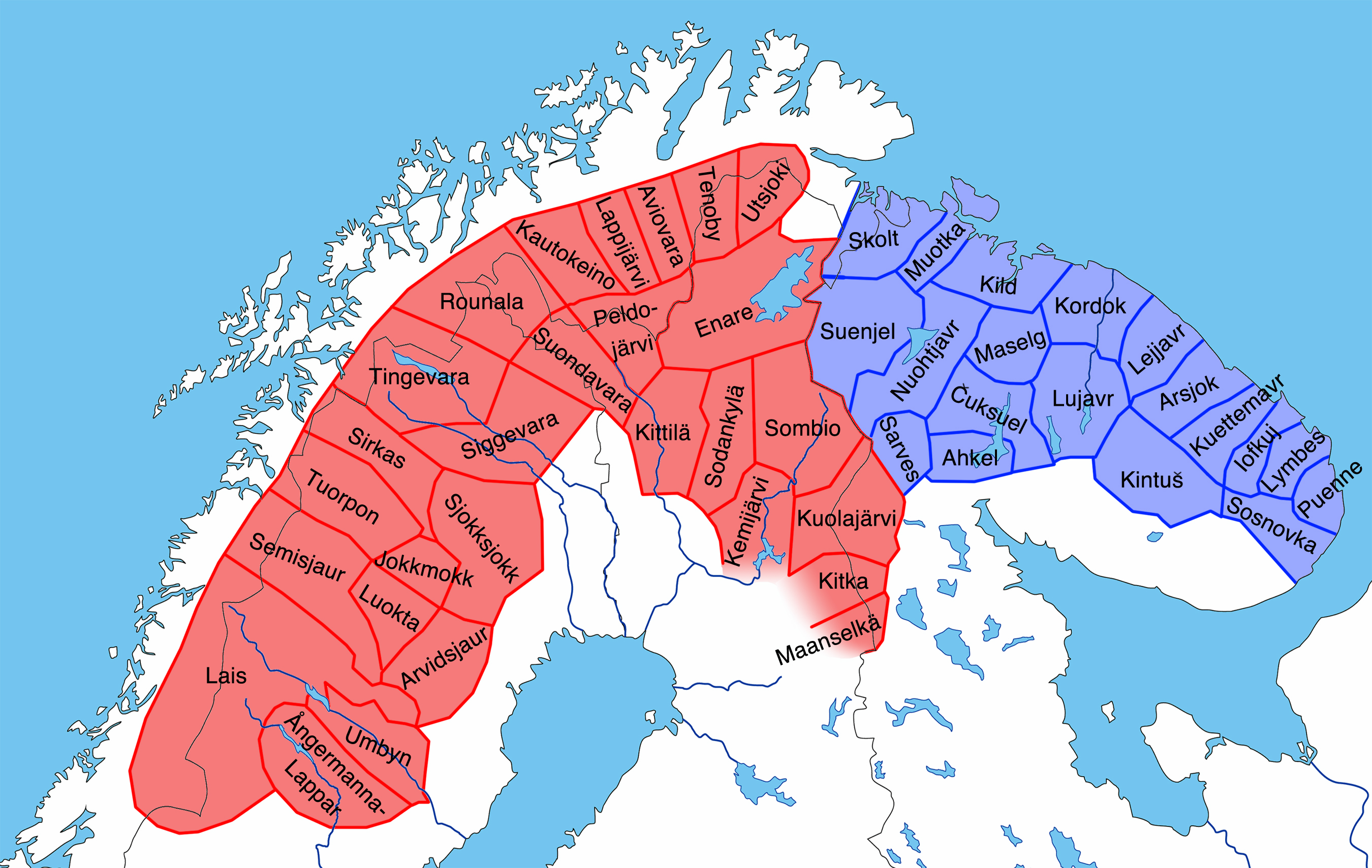
4. Karelia

There's the updated Karelia. You can see the new province in Finland, Kymmenegard.
So while thinking about possigle Karelian states, I realized that this also bothered me somewhat. And it's the extension of Karelian culture. And when I was looking for material I found that my new province is not just more aesthetic, but also historical. It helps to correct the Novgorod-Beloozero boerder. So the province:
Vytegra (Vytegra): fish, woods, novgorodian, to Beloozero state.
Minor changes:
-Laponia state: Lappland, Jokkmokk, Finnmark, Enare, Kola.
-Karelia state: Viborg, Karelen, Priozhersk/Kexholm, White Karelia, Olonets.
-Ingria state: Ingermanland, Neva, Ladoga.
-Change Ingermanland to Karelian culture. I would also like a Finnic culture group with Sapmi, Finnish, Karelian, and Estonian.
-Make Karelian an accepted culture of Novgorod, as they were allies against the Swedes.
-Fixed the border of White Karelia, Enare, Kola and Kajanaland. The grey line is the original border of Kola and White Karelia.
-Ladoga's capital should be Staraya Ladoga (it's viking name Aldeigjuborg could be used by germanic nations).
Sources:
https://en.wikipedia.org/wiki/Vytegra
https://i.pinimg.com/originals/ae/25/3c/ae253cf2eefb09e12aee7208b03f658a.jpg
https://en.wikipedia.org/wiki/Karelia
https://en.wikipedia.org/wiki/Sápmi
https://en.wikipedia.org/wiki/Staraya_Ladoga
https://en.wikipedia.org/wiki/Swedish–Novgorodian_Wars
5. Baltic

As it's already powerful neighbours, the russians and the polish got an update recently, the Livonian Order is in the dire situation at the start of the game. This could be eased somewhat by updating it's terribly outdated map. With green the capital of new provinces.
4 new provinces for Estonia:
Wiek/Laane (Hapsal/Haapsalu): fish <---There was the Bishopric of Wiek.
Pernau/Pärnu (same): naval supplies <--- Important town (possible lvl1 CoT), western part of Fellin.
Fellin/Viljandi (same): livestock <---The strongest castle of the Order.
Wesenberg/Rakvere: (same): grain <--- Quite important town, western half of Narwa.
and 2 for Latvia:
Windau/Ventspils (same): naval supplies <--- Was the main port of the Duchy of Courland.
Selburg/Selonia? (Selburg): livestock <---Carved out from Lettgallen and Mitau to represent Courland better.
(We could merge back the new Wesenberg province to Reval and Narwa, and unite Fellin and Pernau for a more conservative version, but we would still need to add a state, so if it has to be done, do it well.)
Minor changes:
-Change the trade good of Riga to something more prestigious, like cloth, and raise CoT to lvl2.
-Give Reval a lvl1 CoT and change trade good to salt? Change the trade good of Narwa to fish.
-Possible releasable tags: Bishopric of Dorpat, Bishopric of Wiek (Ösel-Wiek, claim on Ösel?).
-Estonia state: Ösel, Wiek, Reval, Wesenberg, Narwa.
-Livonia state: Dorpat, Fellin, Pernau, Wolmar.
-Courland state: Goldingen, Windau, Mitau, Selburg.
-And the new Vidzeme/Latgalia/Wenden state: Riga, Wenden, Dünaburg.
Sources:
https://en.wikipedia.org/wiki/Rakvere
https://en.wikipedia.org/wiki/Pärnu
https://en.wikipedia.org/wiki/Viljandi
https://en.wikipedia.org/wiki/Riga#History
https://en.wikipedia.org/wiki/Cultural_regions_of_Latvia
https://en.wikipedia.org/wiki/Wenden_Voivodeship
http://www.mois.ee/kaart/kaart_eesti_eng.gif
https://upload.wikimedia.org/wikipe...1260.svg/2000px-Medieval_Livonia_1260.svg.png
6. Prussia

As I checked the neighbouring regions I realized Prussia definately belongs to this thread, so I decided to include it in my suggestion. Their main rival, Poland, and Lithuania got an update recently, with a new event, which led the Teutons in a dire situation. Not to mention the Baltic region right now is only 26 province, that's less than half of some other regions. And right next to the (likely soon updated) HRE, Prussia's provinces are enormous. With these changes we could not just represent the region historically more accurate, but also alleviate Prussia's problems. All we have to do is resurrecting the Pomerelia state, and add 3 provinces.
Let me introduce you the possible new provinces:
-Bütow (Lauenburg/Bütow): naval supplies, grassland, pomeranian/kashubian <--- Lauenburg and Bütow had been part of both Pomerania and the Teuton lands.
-Schwetz (same): livestock, grassland, prussian <---One of the oldest towns in the region, added by splitting Tuchel, better representing cultures (Swiecie in polish).
-Intersburg (same): grain, woods, prussian <--- Probably the biggest town in Eastern Prussia after Königsberg.
Minor corrections:
-Revive Pomerelia state: Danzig, Tuchel, Bütow, Schwetz
-West Prussia state: Marienburg, Ermland, Osterode, and maybe Kulm (which is currently in Kuyavia).
-East Prussia state: Königsberg, Intersburg, Ortelsburg, Memel.
-Ortelsburg could have Polish culture.
-Stolp, Bütow, and Tuchel could be Kashubian (West Slavic) culture. With this we could reflect the slavic presence at the region.
-Maybe lvl1 CoT for Kulm?
-Redrawn several provinces to fix borders.
Sources:
https://upload.wikimedia.org/wikipedia/commons/b/bb/Polska_1386_-_1434.png
https://upload.wikimedia.org/wikipedia/commons/2/2b/Teutonic_Order_1410-es.svg
https://upload.wikimedia.org/wikipedia/commons/a/a1/K0nigl+BherzoglPreussen_en.png
https://upload.wikimedia.org/wikipe...huania_-_Geographicus_-_Prussia-cary-1799.jpg
https://en.wikipedia.org/wiki/Chernyakhovsk
https://en.wikipedia.org/wiki/Świecie
https://en.wikipedia.org/wiki/Lauenburg_and_Bütow_Land
https://en.wikipedia.org/wiki/East_Prussia
https://upload.wikimedia.org/wikipedia/commons/f/f8/Netzedistrict1786.png
https://en.wikipedia.org/wiki/Kashubians
http://en.kaszubia.com/wp-content/uploads/2008/09/16401.png
So in total these changes would give 4 new provinces to Scotland, 1 to England, Denmark, Norway, and Novgorod, 3 to Teutonic Order, 5 to Sweden and 6 to Livonian Order.
Thank you for your attention and feel free to add something to the topic
II. Miscellaneous (Under development!)
1. Events.
-Founding the town of Vaasa
-Founding the town of Gothenburg
-Gotland pirate nation on ruler death.
2. Missions
-Hebrides for Norway.
-Estonia for Sweden.
-Colonial mission's for Denmark (Caribbean, Gold Coast, maybe even India -Frederiksøerne, Tranquebar)
-Eastern expansion for Sweden and Denmark.
3. National ideas
Previous similar suggestions:
Minor redraw of Sea provinces around Bornholm: https://forum.paradoxplaza.com/forum/index.php?threads/borders-of-southern-baltic-sea.1035316/ by TheDungen
Baltic patch general stuff: https://forum.paradoxplaza.com/foru...ndic-nordic-patch-general-suggestion.1046616/ by AirikrStrife
Improvements to Livonia: https://forum.paradoxplaza.com/forum/index.php?threads/new-changes-in-baltic-sea.1003803/ by Nikita Dirigable
Scotland: https://forum.paradoxplaza.com/foru...ce-glasgow-or-strathclyde-to-scotland.979713/ by gronak
(Changelog:
- Updated Bothnia and Finland: New province: Kymmenegard, merged Satakunda with Birkaland, reworked Bothnia.
- Updated the Baltic: Merged Rositten&Dünaburg, Wenden stays united, reworked states.
- Added Karelia: New province: Vytegra, reworked states around Karelia
- Updated Scotland: Changed Lanark, now it has a port, not Perth.
- Added Prussia: New provinces: Bütow, Insterburg, Tilsit. Revive Pomerelia state.
- Updated Bothnia: Gastrikland merged back to Halsingland, reworked states.
- Updated Prussia: New province: Schwetz, Tilsit merged back to Memel.
- Updated Scandinavia: New province: Hedemark. Vestfold removed. Sea tiles slightly redrawn.
Thanks to AirikrStrife, gronak, and qweyt for the suggestions. )
Welcome to my suggestion of reworking, perfecting Northern Europe
As the feedbacks are looking positive, i will try to polish this suggestion, so when the time comes we will have a nice rework for the region.
Table of contents:
I. Map changes:
- Scotland
- Scandinavia
- Bothnia and Finland
- Karelia
- Baltic
- Prussia
- Events
- Missions
- National Ideas
1. Scotland
While Scotland got a buff recently, it still feels lacking. England usually easily conquer it until 1500 in one or two wars. So i propose to give more strength and detail to the lowland parts, by dividing it into Central Lowlands and Aberdeen states.
New provinces (capital): trade good, terrain
Moray (Elgin): fish, highland <--- North of Aberdeen.
Angus/Forfar (Dundee): wool/cloth, farmland/highland <---South of Aberdeen.
Lanark (Glasgow): iron, farmland <---Between Lothian and Ayrshire, so you can't move directly between them.
Fife (St. Andrews): livestock, grassland <--- Small, yet important.
Durham (Durham): iron/grain?, grassland <--- South of Northumbria, not part of it.
Minor corrections:
-Put the island of Bute to Argyll province, as it's not even part of the Hebrides.
-Norway could have some missions, regarding the Isles, as it was colonised by them and ruled until 1266.
-Move the CoT from Ayrshire to Lanark (Maybe also the coal, as it was mined in both places, see sources).
-Change the terrain of Argyll, Perth and Aberdeen to Highland from Hills, Change Inverness to Mountains from Highland.
-Move the coal from Northumbria to Durham.
-New Aberdeen state: Aberdeen, Moray, Angus/Forfar.
-Border fixed for Argyll, Perth, Inverness.
Sources:
http://www.scotlandsfamily.com/sct_cmap.gif
https://en.wikipedia.org/wiki/Fife
https://en.wikipedia.org/wiki/County_Palatine_of_Durham
https://en.wikipedia.org/wiki/Lanarkshire
https://en.wikipedia.org/wiki/Moray
https://en.wikipedia.org/wiki/Angus,_Scotland
https://en.wikipedia.org/wiki/Dundee
http://www.wwmm.org/immagini/z_1716.jpg
2. Scandinavia
Scandinavia is one of the best regions in the game, yet it needs a few provinces to be perfect. For example the enormous capital provinces. Besides Sweden is lacking the might to carry out it's historical role, and be a decent rival for Russia or Poland in it's own. So they would need at least a slight buff.
New provinces (capital): trade good
Buskerud (Tonsberg): fur <--- Western half of Akerhus, that was separated from it in the 17th century.
Hedemark (Kongsvinger): naval sup/fur <---- Eastern half of Opplanda.
Roskilde (Roskilde): naval supp/livestock <--- Capital of Denmark until 1443
Jönköping (Jönköping): livestock <--- Maybe a lvl1 CoT, as it was an important market town
Södermanland (Nyköping): fish/livestock <--- Southern part of current Stockholm
Uppland (Uppsala): grain <--- It was the center of the Archdiocese of Sweden
Minor changes:
-Rename the existing Tioharad province to Kronoberg, and change it's tradegood into grain (or maybe livestock)
-Rename Östergotland to Linköping, because that's the state's name.
-There could be an event for the founding of Gothenburg.
-The strait's danish end should be in Copenhagen province, not Roskilde.
-Now there's enough provinces for a decent Östra Svealand with Södermanland, Uppland, Stockholm and maybe Aland, so Bergslagen can be moved to Vastra Svealand state where it does belong.
-Sea tiles slightly redrawn to represen the Öresund better.
Sources:
https://en.wikipedia.org/wiki/Counties_of_Sweden
https://en.wikipedia.org/wiki/Jönköping
https://en.wikipedia.org/wiki/Roskilde
https://en.wikipedia.org/wiki/Buskerud
https://en.wikipedia.org/wiki/History_of_Gothenburg
3. Bothnia and Finland
While the map projection shows this area a lot larger than it is really, some provinces are still awfully big (especially Halsingland, compared to being relatively on the south). Besides, Finnish provinces with this little polish perfectly reflect the area at the time. Red dots are the capitals of the -
New provinces (capital): trade good
Angermanland (Härnösand): fish <---Northern part of current Halsingland.
Kymmenegard (Heinola/Pyttis): fish <---Carved out of Savolax, Nyland and Viborg, alternative name Kymmenedalen.
Minor changes:
-Norrland state: Västerbotten, Angermanland, and Halsingland.
-Lappland and Jokkmokk to Laponia state.
-Ostrobothnia/Österbotten state and Enare redrawn.
-Birkaland merged with the northern part of Åbo to form Björneborg/Satakunda province (Ulsby).
-Finland Proper/Western Finland state: Åland, Satakunda, Åbo.
-The new Tavastia/Central Finland state: Nyland, Tavastland, Savolax, Kymmenegard.
-The region also lacks center of trades. Potential lvl1 CoTs: Åbo, Viborg.
-There could be an event in the 17th century for Sweden for the founding the town of Vaasa in Österbotten.
Sources:
https://en.wikipedia.org/wiki/Ångermanland
https://en.wikipedia.org/wiki/Gävle
https://en.wikipedia.org/wiki/Satakunta
https://en.wikipedia.org/wiki/Turku
4. Karelia
There's the updated Karelia. You can see the new province in Finland, Kymmenegard.
So while thinking about possigle Karelian states, I realized that this also bothered me somewhat. And it's the extension of Karelian culture. And when I was looking for material I found that my new province is not just more aesthetic, but also historical. It helps to correct the Novgorod-Beloozero boerder. So the province:
Vytegra (Vytegra): fish, woods, novgorodian, to Beloozero state.
Minor changes:
-Laponia state: Lappland, Jokkmokk, Finnmark, Enare, Kola.
-Karelia state: Viborg, Karelen, Priozhersk/Kexholm, White Karelia, Olonets.
-Ingria state: Ingermanland, Neva, Ladoga.
-Change Ingermanland to Karelian culture. I would also like a Finnic culture group with Sapmi, Finnish, Karelian, and Estonian.
-Make Karelian an accepted culture of Novgorod, as they were allies against the Swedes.
-Fixed the border of White Karelia, Enare, Kola and Kajanaland. The grey line is the original border of Kola and White Karelia.
-Ladoga's capital should be Staraya Ladoga (it's viking name Aldeigjuborg could be used by germanic nations).
Sources:
https://en.wikipedia.org/wiki/Vytegra
https://i.pinimg.com/originals/ae/25/3c/ae253cf2eefb09e12aee7208b03f658a.jpg
https://en.wikipedia.org/wiki/Karelia
https://en.wikipedia.org/wiki/Sápmi
https://en.wikipedia.org/wiki/Staraya_Ladoga
https://en.wikipedia.org/wiki/Swedish–Novgorodian_Wars
5. Baltic
As it's already powerful neighbours, the russians and the polish got an update recently, the Livonian Order is in the dire situation at the start of the game. This could be eased somewhat by updating it's terribly outdated map. With green the capital of new provinces.
4 new provinces for Estonia:
Wiek/Laane (Hapsal/Haapsalu): fish <---There was the Bishopric of Wiek.
Pernau/Pärnu (same): naval supplies <--- Important town (possible lvl1 CoT), western part of Fellin.
Fellin/Viljandi (same): livestock <---The strongest castle of the Order.
Wesenberg/Rakvere: (same): grain <--- Quite important town, western half of Narwa.
and 2 for Latvia:
Windau/Ventspils (same): naval supplies <--- Was the main port of the Duchy of Courland.
Selburg/Selonia? (Selburg): livestock <---Carved out from Lettgallen and Mitau to represent Courland better.
(We could merge back the new Wesenberg province to Reval and Narwa, and unite Fellin and Pernau for a more conservative version, but we would still need to add a state, so if it has to be done, do it well.)
Minor changes:
-Change the trade good of Riga to something more prestigious, like cloth, and raise CoT to lvl2.
-Give Reval a lvl1 CoT and change trade good to salt? Change the trade good of Narwa to fish.
-Possible releasable tags: Bishopric of Dorpat, Bishopric of Wiek (Ösel-Wiek, claim on Ösel?).
-Estonia state: Ösel, Wiek, Reval, Wesenberg, Narwa.
-Livonia state: Dorpat, Fellin, Pernau, Wolmar.
-Courland state: Goldingen, Windau, Mitau, Selburg.
-And the new Vidzeme/Latgalia/Wenden state: Riga, Wenden, Dünaburg.
Sources:
https://en.wikipedia.org/wiki/Rakvere
https://en.wikipedia.org/wiki/Pärnu
https://en.wikipedia.org/wiki/Viljandi
https://en.wikipedia.org/wiki/Riga#History
https://en.wikipedia.org/wiki/Cultural_regions_of_Latvia
https://en.wikipedia.org/wiki/Wenden_Voivodeship
http://www.mois.ee/kaart/kaart_eesti_eng.gif
https://upload.wikimedia.org/wikipe...1260.svg/2000px-Medieval_Livonia_1260.svg.png
6. Prussia
As I checked the neighbouring regions I realized Prussia definately belongs to this thread, so I decided to include it in my suggestion. Their main rival, Poland, and Lithuania got an update recently, with a new event, which led the Teutons in a dire situation. Not to mention the Baltic region right now is only 26 province, that's less than half of some other regions. And right next to the (likely soon updated) HRE, Prussia's provinces are enormous. With these changes we could not just represent the region historically more accurate, but also alleviate Prussia's problems. All we have to do is resurrecting the Pomerelia state, and add 3 provinces.
Let me introduce you the possible new provinces:
-Bütow (Lauenburg/Bütow): naval supplies, grassland, pomeranian/kashubian <--- Lauenburg and Bütow had been part of both Pomerania and the Teuton lands.
-Schwetz (same): livestock, grassland, prussian <---One of the oldest towns in the region, added by splitting Tuchel, better representing cultures (Swiecie in polish).
-Intersburg (same): grain, woods, prussian <--- Probably the biggest town in Eastern Prussia after Königsberg.
Minor corrections:
-Revive Pomerelia state: Danzig, Tuchel, Bütow, Schwetz
-West Prussia state: Marienburg, Ermland, Osterode, and maybe Kulm (which is currently in Kuyavia).
-East Prussia state: Königsberg, Intersburg, Ortelsburg, Memel.
-Ortelsburg could have Polish culture.
-Stolp, Bütow, and Tuchel could be Kashubian (West Slavic) culture. With this we could reflect the slavic presence at the region.
-Maybe lvl1 CoT for Kulm?
-Redrawn several provinces to fix borders.
Sources:
https://upload.wikimedia.org/wikipedia/commons/b/bb/Polska_1386_-_1434.png
https://upload.wikimedia.org/wikipedia/commons/2/2b/Teutonic_Order_1410-es.svg
https://upload.wikimedia.org/wikipedia/commons/a/a1/K0nigl+BherzoglPreussen_en.png
https://upload.wikimedia.org/wikipe...huania_-_Geographicus_-_Prussia-cary-1799.jpg
https://en.wikipedia.org/wiki/Chernyakhovsk
https://en.wikipedia.org/wiki/Świecie
https://en.wikipedia.org/wiki/Lauenburg_and_Bütow_Land
https://en.wikipedia.org/wiki/East_Prussia
https://upload.wikimedia.org/wikipedia/commons/f/f8/Netzedistrict1786.png
https://en.wikipedia.org/wiki/Kashubians
http://en.kaszubia.com/wp-content/uploads/2008/09/16401.png
So in total these changes would give 4 new provinces to Scotland, 1 to England, Denmark, Norway, and Novgorod, 3 to Teutonic Order, 5 to Sweden and 6 to Livonian Order.
Thank you for your attention and feel free to add something to the topic
II. Miscellaneous (Under development!)
1. Events.
-Founding the town of Vaasa
-Founding the town of Gothenburg
-Gotland pirate nation on ruler death.
2. Missions
-Hebrides for Norway.
-Estonia for Sweden.
-Colonial mission's for Denmark (Caribbean, Gold Coast, maybe even India -Frederiksøerne, Tranquebar)
-Eastern expansion for Sweden and Denmark.
3. National ideas
Previous similar suggestions:
Minor redraw of Sea provinces around Bornholm: https://forum.paradoxplaza.com/forum/index.php?threads/borders-of-southern-baltic-sea.1035316/ by TheDungen
Baltic patch general stuff: https://forum.paradoxplaza.com/foru...ndic-nordic-patch-general-suggestion.1046616/ by AirikrStrife
Improvements to Livonia: https://forum.paradoxplaza.com/forum/index.php?threads/new-changes-in-baltic-sea.1003803/ by Nikita Dirigable
Scotland: https://forum.paradoxplaza.com/foru...ce-glasgow-or-strathclyde-to-scotland.979713/ by gronak
(Changelog:
- Updated Bothnia and Finland: New province: Kymmenegard, merged Satakunda with Birkaland, reworked Bothnia.
- Updated the Baltic: Merged Rositten&Dünaburg, Wenden stays united, reworked states.
- Added Karelia: New province: Vytegra, reworked states around Karelia
- Updated Scotland: Changed Lanark, now it has a port, not Perth.
- Added Prussia: New provinces: Bütow, Insterburg, Tilsit. Revive Pomerelia state.
- Updated Bothnia: Gastrikland merged back to Halsingland, reworked states.
- Updated Prussia: New province: Schwetz, Tilsit merged back to Memel.
- Updated Scandinavia: New province: Hedemark. Vestfold removed. Sea tiles slightly redrawn.
Thanks to AirikrStrife, gronak, and qweyt for the suggestions.
)
Last edited:
- 2
- 1

.847822d17993f848f6ccba15d2628e90496.jpg)


.png "2019-04-02 (1).png")
.png "2019-04-02 (3).png")
.png "2019-04-02 (6).png")

