• We have updated our Community Code of Conduct. Please read through the new rules for the forum that are an integral part of Paradox Interactive’s User Agreement.

KaRei

Lt. General
14 Badges
Dec 27, 2005
1.588
47
  • Ancient Space
  • Crusader Kings II
  • Europa Universalis III
  • Divine Wind
  • For The Glory
  • Heir to the Throne
  • Majesty 2 Collection
  • Victoria: Revolutions
  • Rome Gold
  • Sengoku
  • Rome: Vae Victis
  • Europa Universalis III: Collection
  • Stellaris
  • Age of Wonders
Ptolemy World Map


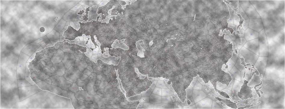
It will be a lot of work and will take a lot of time, but without trying it one won't know whether he's able to do such thing and finish it or not. So right now I'm starting a new map supposed to be for ancient times (ages before common era and the first few centuries of common era). The map shall contain Europe, North Africa, Central Asia, India, Indo-China and China and probably will be expanded little more to the east to give a place also to Japan and Korea. The world will be bordered with PTI making it impossible to go around the world, and excluding from the map continents of America, Australia, Oceania and south part of Africa.


Development ABANDONED

Download
(version 0.a.4)


Download ID map

Documentation:
Climates
 
Last edited:
KaRei said:
And on the last, but not least place, I'd like to ask for some help from more experienced map creators to help me with the beginning. :D
For now I have these questions:
1) What size the sheet for map can have?
2) How many provinces are supported by Eu2 1.09?
3) How I'll know which color should a province have to give her a specific ID?


1. There's only one size, 18944x7296, which is the original size.
2. 2020, but 0 is PTI and 2019 and 2020 can not be used..
3. open cmd and type the path to your magellan programs. then add :

Code:
MCOLOR /MAP

This creates a png image. It shows you a range of numbers with colorcodes next to them use those.
 
I'm looking for some nice map of ancient china, indochina, Scythia, Sarmatia and Central Asia.
Something from a period of about 500 BC - 200 AD.
Does somebody have something like that?
Help is welcomed :)


EDIT:
For China it is a period of Zhou, Qin and Han dynasties.
 
Last edited:
I have copies of some maps of Iran and central Asia from historical atlas of Iran, from ancient times only The Parthian Empire and the Sassanids...

but I can try to get the atlas and make also copies of more ancient times (the Atlas was made on purpouse of 2500th anniversary of Iran so IIRC there were at least the Achaemenids)
 
elvain >> That would be great. I have just some rought maps of that territory from which I can't make too many provinces in that area. Something more detailed would be really great. :)

The Swert >> Wow! Great link. It isn't so much helpful with the province creating, but it will greatly help in creation of the mod. :)
I was for a long time searching for some chronological world wide maps. Those you sent are exactly what I needed :)

I drawn already provinces of Moesia, Dacia, Illyria, Pannonia, Noricum and Rhaetia. I'll send the pic when I return home. I'll need some historical criticism of the naming of the provinces (the more north the provinces are, the more they are named after tribes).
 
As I promised (only a bit later), here is a preview of Dacia, Moesia, Rhaetia, etc.
Higher priority in province naming have regional names, then major cities, and on the last place (as en emergency naming) tribal names. I'd like to replace as many tribal names as possible by regional names. If anybody know some ancient name of a region, where is still a tribal name, suggest a correction. The only condition is that the regional name must be from times of this map. ;)


And to make the orientation a bit easier, here is a same map with drawn borders between historical Roman provinces. These will be used as in-game areas. :)

 
Thanks Birger. Glad you like it. :)
Here is a preview of another expansion. This time added Gallia and Hispania:


Here I need a little help from somebody with knowledge of ancient Spain. I'd like to split province of Vaccaei (northern part of Hispania Tarraconensis), however I couldn't find any other tribe there. Help with searching for a "province" name for area between Douro river and Mons Cartpetanus is welcomed (it's a place which looks like unlabeled province on the map, south from Vaccaei). ;)

EDIT:
And whoever can help me with searching for sources by which it would be possible divide Scythia and Sarmatia (Ukraine, Russia), I'll be happy. Roman maps ends with Germania and Dacia, and from Scythian territory north from Black and Caspian sea I have almost nothing. Thanks. :)
 
Last edited:
that't simply great! keep it up.

I promised you some maps and I am sorry I haven!t posted them yet, but don"t beafraid, I will send them as soon as I have more time.

PS: I guess you don't need help with Bohemia, do you? :)
 
elvain said:
that't simply great! keep it up.

I promised you some maps and I am sorry I haven!t posted them yet, but don"t beafraid, I will send them as soon as I have more time.

PS: I guess you don't need help with Bohemia, do you? :)
Thanks :)

The Germania surprised me a lot. Although it was beyond the borders of Roman influence, in roman geography it's very detailed. For the area of Bohemia it looks that there shouldn't be a problem to create 3 provinces or even more. I looked on it only in quick and it looks very good. :)

To sumarize the troublesome areas where is a lack of sources and where help will be needed:
- Scandinavia and Finland, Estonia
- Scythia (Ukraine and Russia)
- Siberia (at least southern strip)
- Central Asia (east of Caspian sea as far as the Tarim basin)
- Persia and Arabia
- China and Tibet (especially the western part of China and the Tibet)
- Indo-China
 
I didn't send an update for some time, so here it goes ;)


In this step was done Britannia, Hibernia (Ireland) and Germania.

Now I'm aiming on Asia Minor and Africa.
 
Hmmm, I don't think that they are too small. But yes, there is a lot of provinces much smaller than classical Eu2 standard. If it won't collide with the province number limit for map or the section, I'll probably keep them like this. If there would be too many provinces and some would need to be removed to meet the limit, the smallest and less important provinces will be merged. :)
 
Good luck! This is looking very interesting! Any plans for scenario's on this map?