• We have updated our Community Code of Conduct. Please read through the new rules for the forum that are an integral part of Paradox Interactive’s User Agreement.

AirikrStrife

Bergakungen
20 Badges
Jul 30, 2010
2.292
1.827
  • Europa Universalis IV: Art of War
  • Europa Universalis IV: Conquest of Paradise
  • Europa Universalis IV: Res Publica
  • Europa Universalis IV: Mare Nostrum
  • Europa Universalis 4: Emperor
  • Imperator: Rome Sign Up
  • Europa Universalis IV: Golden Century
  • Europa Universalis IV: Dharma
  • Europa Universalis IV: Rule Britannia
  • Europa Universalis IV: Cradle of Civilization
  • Europa Universalis IV: Third Rome
  • Europa Universalis IV: Mandate of Heaven
  • Europa Universalis IV: Rights of Man
  • Crusader Kings II
  • Europa Universalis IV: Cossacks
  • Europa Universalis IV: Common Sense
  • Europa Universalis IV: Pre-order
  • Europa Universalis IV: El Dorado
  • Europa Universalis IV: Wealth of Nations
  • Europa Universalis IV
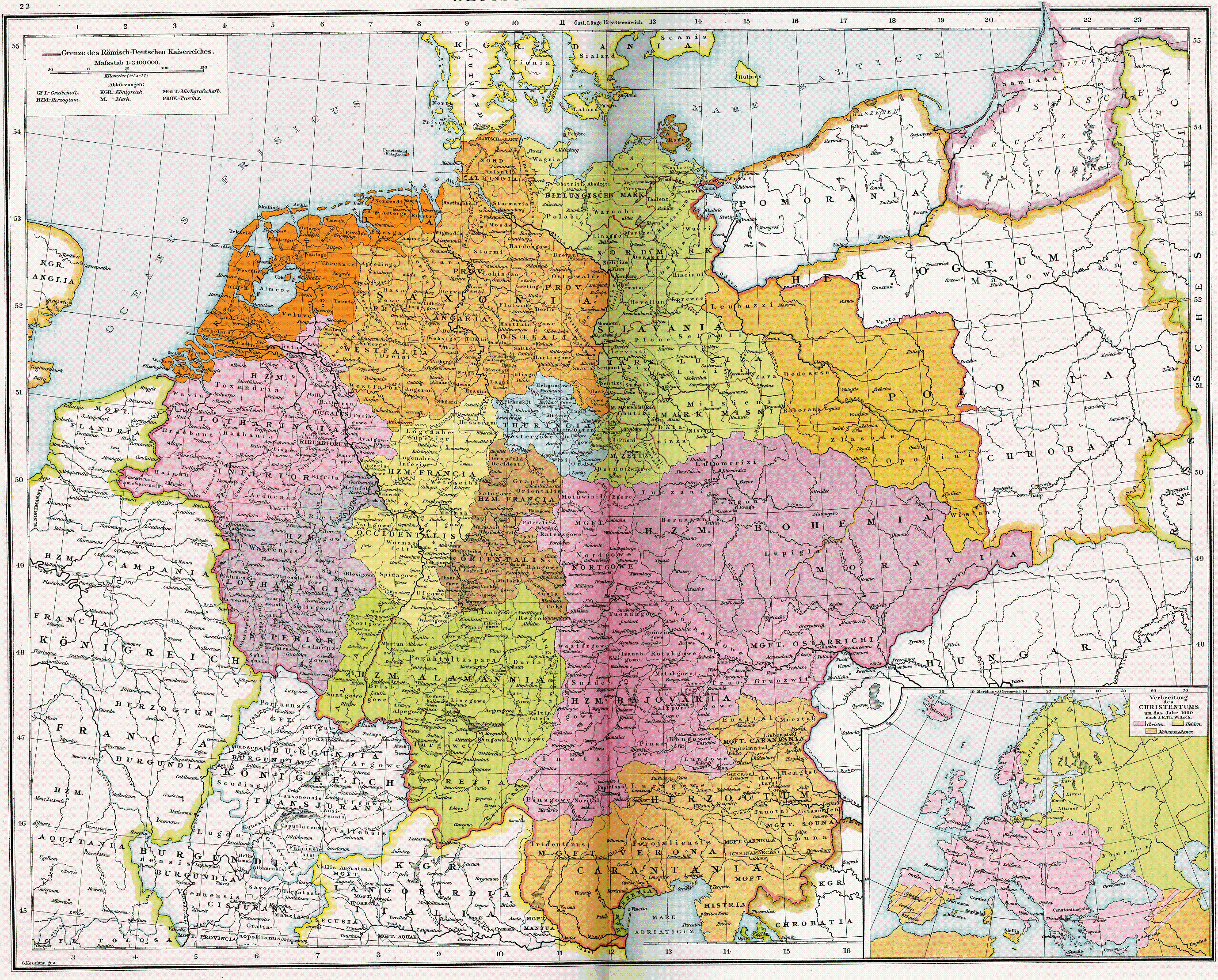
I already have a few threads on this topic, and originally this was just planned on being a thread on the welf land and the lands in modern Sachsen-Anhalt, but I simply decided to add up the material from my other threads to show a holistic overhaul. The territory in question is territory where low german where or would recently have been spoken. I'm posting my entire map as one map and then describe in spoilers changes region by region including reference maps
(Pommerania were aldready updated after my previous thread on the region)


My map itself
north germany.png


With the new government reforms theocracies might finally be worth playing, but also this previous suggestion by my gives very interesting flavor to the theocracy game
https://forum.paradoxplaza.com/forum/index.php?threads/spicing-up-theocracies.1228918/

In germany, many prince-bishoprics formed personal unions, sometimes one bishop ruling 4-6 different prince-bishoprics. Making a mechanic for this would make prince-bishoprics more interesting and make it more worthwhile to keep more of them around as tags

Changes or consdierations, region by region

Map for reference
Reichskreis_Niederrhein-Westfalen_1710.jpg

Shaped provinces according to actual division of territory, showing of more proper borders between lower münster/meppen (1 on map), upper Münster (4 on map) divided by the prince-bishopric of Osnabrück (2) and duchy of Bentheim-Lingen (3). Osnabrück remains part of Münster while I would suggest Tecklenburg start as independent, thought it could optionally also be part of Münster

I then reworked the city of Dortmund into the county of Mark, which belongs to Cleves. The reasoning is that Dortmund were a fairly small city in the 15th century and this way the significant Cleves duchy isn't reduced to an OPM.

The circle marked 6 is a bit of a challenge as it contains four different territories, the duchy of ravensberg (in union with Berg), the lordship of Lippe, the county of Shaumburg and the prince-bishopric of Minden.
I would suggest that Lippe becomes it's own province with the tag (as the tag already exists), that Schaumburg either is joined to Lippe, or remains in the hannover province there it currently is (after the extinction of the schaumburg, part of the county went to hannover, part formed a new county under Lippe and one part went to Hessen). Ravensberg alongside Minden forms the province of Ravensberg and belongs to Berg

Events:
Event relating to the anabtist rebellion in Münster https://en.wikipedia.org/wiki/Münster_rebellion

Territories ruled by the Welf Dynasty (Duchy of Brunswick-Lüneburg and Kurhannover)
Map for reference:
Overview-of-the-Entire-Guelph-Duchy-of-Brunswick-Lueneburg-around-1500-White-areas.png

I suggest adding a third Welf state in the area, as it is strange now the Calenberg line does not exist in game despite that being the line creating Kurhannover and later the kingdom of Hannover, instead having one large Brunswick (I don't know exactly what this is supposed to represent, but I assume it to be the principality of Brunswick-Wolfenbüttel which would go on to exist as it's own state until 1918, but where not as oversized as current Brunswick state.
The Calenberg line could be represented by the Hannover tag, if that is not too much a problem with current decisions etc otherwise a new Calenberg tag can be made. The ruler of Calenberg is William the victorious https://en.wikipedia.org/wiki/William_the_Victorious,_Duke_of_Brunswick-Lüneburg brother of the duke of the ruler of Brunswick
Notes Hoya, if not made an idnependent OP should belong to Calenberg; Göttingen where still an independent line that merged with Calenberg in 1463, but I have them together already by 1444 to avoid too many different state.
I did add the prince-bishopric of Hildesheim into the game (the blue H), it was quite significant, but it could be replaced by an extra province for Brunswick-Wolfenbüttel, as they otherwise are an OPM

The Welf duchies should obviously also have their own mission tree, including missions to unite the three principalities, expanding to the coast, becoming electors and eventually form a union with england.

map for reference:
Luther_region_1519.png

Kurf%C3%BCrstentum_Sachsen_um_1600_in_Abgleich_mit_den_heutigen_Bundel%C3%A4ndern.png

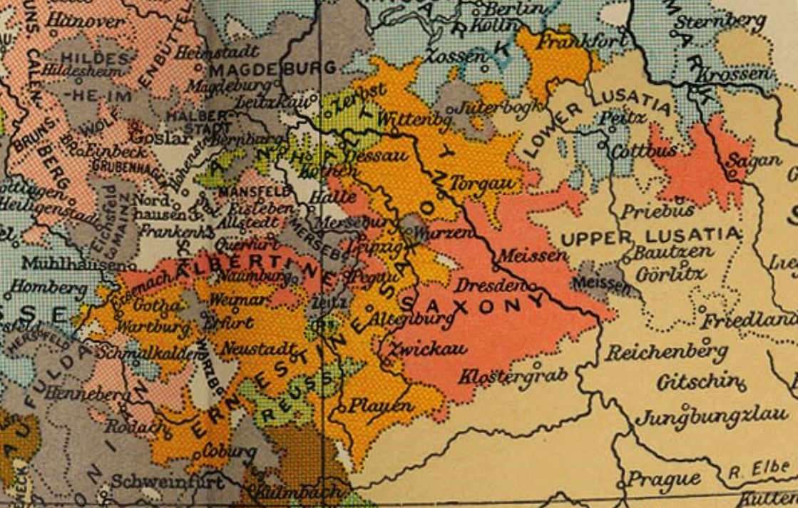
The territory of modern Sachsen-Anhalt is a real mess, I tried to sort some things out for a better game experience. First of I disliked the new bulky shapy of the DUchy of Anhalt that it had after the addition of the Halle province, I redraw it back to it's old beautiful slick form. The area south of Anhalt is one of the trickier ones.
It contains a multitutde of small places like the Halle exclave of Magdeburg, the county of Mansfeld and the prince-bishopric of Merseburg. The area in question I drew as a few blac kslashes and are suggesting keeping it wither as Halle, part of Magdeburg, or making it into a Merseburg province whihc could either be a princ-bishopric or belong to Sachsen

I did split the main bulk of Magdeburg in two parts, Magedeburg west of the Elbe and Burg east of the Elbe. My initial plan was to make a province for Halberstadt and the Harzgau region, but it came out too small so I went with this split instead which did happen historically during the napoleonic wars when Napoleon took Magdeburg and left the transelbe part with Brandenburg
I did remove the ciselbe part of the panhandle and gave it to altmark, as all maps from later shows this, (only medieval maps I looked at shows it as it is in the game)


Talking about Anhalt and the Ascanien house (which also rules Saxe-Lauenburg), they should have some missions of their won. First to unite the duchies, then restoring eletoral diggnity alongside the city of Wittenberg and also to reclaim mark brandenburg, a creation of the ascanian Albert the Bear

Special event could also exist for when an Ascanian princess becomes empress-consort of russia to overthrow her husband as historically the anhalt princess Sophia of Zerbst would become empress of Russia under the name Catherine (the great) by doing so.

I would also suggest using a more distinct CoA for Anhalt, namely one with a bear on a wall like this one (some variations exist)
220px-DEU_Anhalt_1924-1945_COA.svg.png

Herzogtum_Sachsen_Lauenburg_1400.PNG

As can be seen on my map, I better improved the borders of Dithmarschen and Lauenburg, making Hamburg and Lübeck smaller making for quite a large Holstein provicne which can be divided into at least two provinces, in my map Rendsburg and Kiel

Mittelmark (the core of Brandenburg) as it is now is just selecting larger cities and making a proivnce around that city. I have worked with actual historical divisions of the mark to form new provinces:

Maps for references:
Stra%C3%9Fennetz_und_St%C3%A4dte_Mark_Brandenburg_1648.png

Kur_Brandenburg.jpg

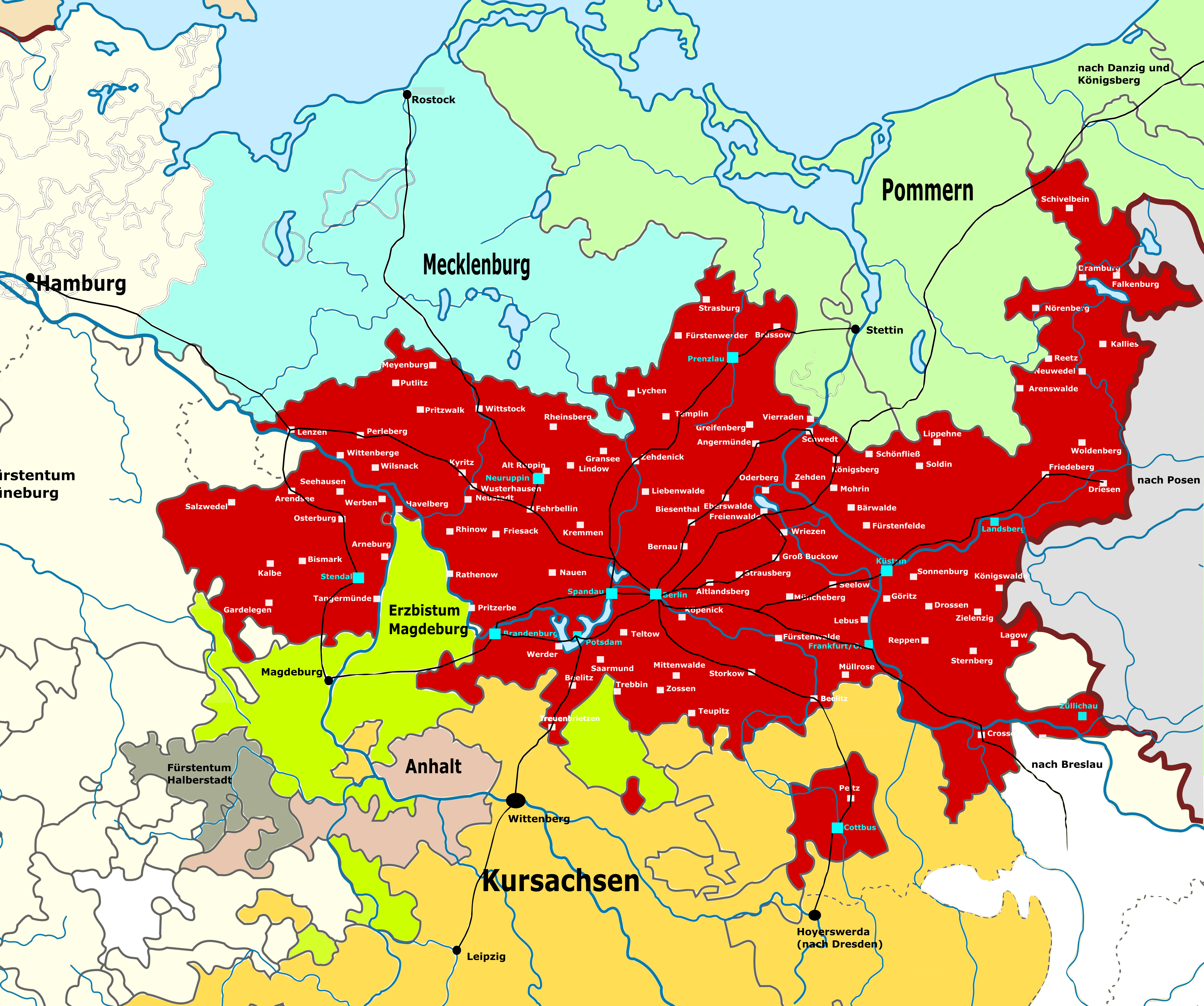
My new provinces are:
Prignitz (P) and Barnim (Ba).
As Berlin currently only includes northern parts of Berlin city I moved it south to include the Teltow area and several of the smaller duchies which had, or would be swallowed by the Mark (Be on my map). Making Barnim a new (very poorly-developed province)

I have turned around Brandenburg an der Havel (represented with a Z - Zauche on my map) and Potsdam (represented by a H- Havveland on my map) to better represent the historical divisions of the country

I also improved the position of Neumark and Dramburg provinces. If this is becoming too many provinces I would suggest ditching Dramburg (merging with Neumark) or Ruppin*
*In my suggestion, Ruppin and Prignitz are separated provinces, but they could be one province but then I would call that province Prignitz, rather than Ruppin, at least until the Ruppin inheritence event fires.

@Caligula Caesar for a more immersive experience in northern germany
 
  • 1
Reactions:
Upvote 0
I would love to see some changes in northern Germany, but it's probably too late for that.
Unless they changed something in northern Germany and have not yet shown but I doubt it.
 
I would love to see some changes in northern Germany, but it's probably too late for that.
Unless they changed something in northern Germany and have not yet shown but I doubt it.


Yeah, my hopes are quite low, though I think these changes, that includes about 6 new provinces and 3 new tags would really be giving a lot for the immersion and I made this map after recently having had discussions about germany and related to sachsen-anhalt and berlin and that got me thinking about my own wishes for playing a game in the region. This is how I would want it to be for my own games there, what I miss and how the upcoming map is sadly a bit lacking
 
Actually one of my last acts on the EU4 team was to make some changes following your and others' feedback :) (But not as extensive as you suggest - Prignitz now exists and Munster's provinces layout is a bit more accurate geographically).
 
Actually one of my last acts on the EU4 team was to make some changes following your and others' feedback :) (But not as extensive as you suggest - Prignitz now exists and Munster's provinces layout is a bit more accurate geographically).
Is there a chance to get a preview of the map changes, of course if you can ?.
 

I find these changes completely satisfying, glad to see the improved Westphalia and the new province, but there's one thing:

I guess because Brandenburg is too crowded now, you had to detach a province. And Prignitz, on the western corner seemed like the obvious choice, looks like it's part of Mecklenburg area now.
The problem with this, Prignitz never had anything to do with Mecklenburg, and always been part of Brandenburg, and it's precedessor, the Nordmark.
El-Sacro-Imperio-Romano-Germanico-circa-1000-1296.png

But there's an other province with weaker ties to Brandenburg: Uckermark
As I mentioned Brandenburg is the successor state of the Northern March, which had nearly identical borders. A notable exeption is it's north-eastern border. Most of the current Stargard/Neubrandenburg province, and Uckermark were both part of the March originally. However this region was heavily contested by Brandenburg, Mecklenburg, Pomerania, and for a time even Denmark. While Neubrandenburg got lost to Mecklenburg, and remains part of it until this day, Uckermark got recovered by Brandenburg. But not without a fight. Pomerania-Stettin accepted the loss of Uckermark, and Brandenburg consolidated it's rule over it only in the peaces of Prenzlau in 1472(https://en.wikipedia.org/wiki/Treaty_of_Prenzlau).
So in the 15th century Uckermark was the region which was considered the be the least stable part of Brandenburg. This act of replacing Uckermark to Pomerania could also represent Brandenburg's gain of a grip in the region.


Long story short Uckermark has some historical basis to be reshuffled to Vorpommern, while Prignitz have nothing to do with Mecklenburg.
I also find this solution more aesthetical on the map.

I hope you guys consider changing this.
 
Last edited:


Accepting that the Münsterland and Brandenburg are good enough (after hopefully fixing the areas per Entrone's suggestion), and very thankful for the responses and consideration being given to mine and others suggestions. This is the first time (afaik) brings the question of the Welf lands into consideration

I still feel strange about the current holdings of Lippe, as the province of Ravensberg doesn't even include the Lordship, despite it being a releasable tag. Either Ravensberg should be enlarged, the tag moved to Paderborn or a province for Lippe and Schaumburg made.


welf land.png

The L is Lippe, with the Lordship of Lippe south of the river and Schaumburg north of it

The H is Hildesheim
I will suggest two options.
1. Make Hildesheim an OPM prince-bishopric
or
2. Split the Welf Lands between Brunswick and Calenberg
Brunswick own Brunswick and Hildesheim
Calenberg owns Hannover, Göttingen and Hoya
 
Thanks for showing changes on the map.
I noticed that the location of the city of Glogów has still not been improved.
I know that this thread is focused on northern Germany, But seeing that you are able to listen to the community regarding changes on the map, I would like to propose adding two new provinces in Silesia, namely Świdnica and Cieszyn, as well as adding two principals in Silesia, namely the Teschen principality and the principality of Racibórz.
Adding these proposed changes would give Silesia more depth.
Sorry to write about Silesia in a thread about northern Germany.

Although I would love to see these changes in game, it is very unlikely.

But, in my opinion, one province more for Silesia sounds very reasonable. Świdnica seems like the best choice here.

Two states, three provinces each.
Two tags, three provinces each.

Balance.
 
Last edited:
Although I would love to see these changes in game, it is very unlikely.

But, in my opinion, one province more for Silesia sounds very reasonable. Świdnica seems like the best choice here.

Two states, three provinces each.
Two tags, three provinces each.

Balance.
Personally I would like to see Teschen as well. And maybe Opava in the western part owned by Opole but in Moravia state.
https://en.wikipedia.org/wiki/Opava

Modern day in Moravia, but in history it had its own Silesian Duchy.

Plus would fit nicely with the Austrian Silesia

1024px-Österreichisch-Schlesien_1746_en.svg.png
 
Last edited:
Personally I would like to see Teschen as well. And maybe Opava in the western part owned by Opole but in Moravia state.
https://en.wikipedia.org/wiki/Opava

Plus would fit nicely with the Austrian Silesia

Ratibor province currently serves that role. It was mentioned that if Austria rules it changes name to Teschen, as I remember. Opava and Teschen probably would be too small to represent them separately.

Sorry to write about Silesia in a thread about northern Germany.

Sorry to not to write about your Silesia in a thread about Northern Germay ( :D ), but I spotted how you also highlighted that Neumark extended down south until the Warta river, just like AirikrStrife.
He also drawn the city states smaller.

While of course your observations are correct, please note that such accuracy is not at all the aim of the game.

What's the point of relieving Sternberg of it's northernmost bits? Give the devs something to do, while they find all the pixels which are north of the river?
For what, to have a nearly twice as big Neumark as Sternberg? There's no reason to do it, it won't change anything, except gain some accuracy on the price of aesthetics.
It should, and probably will, get changed with the surrounding, much more serious mistakes (like Tuchel province, or even Greater Poland's weird and unpopular inner borders).

Or what's the point of making unclickably small provinces? New provinces in general, and in this case in Holstein are not dependent on the size of the already small freistadts. Those redrawn Lübeck and Hamburg are completely unrealistic. If you scroll out in the game to see the names of countries, not provinces, you couldn't even detect them... Hamburg wouldn't even have enough space to show a fort or manufactory, maybe not even a few houses.

The aim is not a completely accurate presentation, but one with compromises to represent the map as accurately as possible, without hampering game experience.
In this case balancing province sizes a bit, which makes Hamburg and Sternberg bigger than they were, but the map is smoother in general.

I just don't get it why does it matter at all, that for example Sternberg has those pixels, when whole (big and important) rivers are misplaced (like the Danube, which flows like 40km to the north compared to reality).

Regarding your Silesia, I like it more than your previous version with Zagan, but as pointed out in an other thread a few days earlier:
What makes Silesia "better" than other core areas, to have it divided in two? Like why Silesia should be 2 state and 7 province, when Normandy, Greater Poland, Jutland or other similar sized areas with similar importance, can fit into 5 province and 1 state, for now. Very few exeptions exist now, usually extremely densely populated areas, like Lombardy or the old Netherlands state.
I hope we will get a Silesia similar to this one day, probably in the next HRE patch.
 
Last edited:
Ratibor province currently serves that role. It was mentioned that if Austria rules it changes name to Teschen, as I remember. Opava and Teschen probably would be too small to represent them separately.


Sorry to not to write about your Silesia in a thread about Northern Germay ( :D ), but I spotted how you also highlighted that Neumark extended down south until the Warta river, just like AirikrStrife.
He also drawn the city states smaller.

While of course your observations are correct, please note that such accuracy is not at all the aim of the game.

What's the point of relieving Sternberg of it's northernmost bits? Give the devs something to do, while they find all the pixels which are north of the river?
For what, to have a nearly twice as big Neumark as Sternberg? There's no reason to do it, it won't change anything, except gain some accuracy on the price of aesthetics.
It should, and probably will, get changed with the surrounding, much more serious mistakes (like Tuchel province, or even Greater Poland's weird and unpopular inner borders).

Or what's the point of making unclickably small provinces? New provinces in general, and in this case in Holstein are not dependent on the size of the already small freistadts. Those redrawn Lübeck and Hamburg are completely unrealistic. If you scroll out in the game to see the names of countries, not provinces, you couldn't even detect them... Hamburg wouldn't even have enough space to show a fort or manufactory, maybe not even a few houses.

The aim is not a completely accurate presentation, but one with compromises to represent the map as accurately as possible, without hampering game experience.
In this case balancing province sizes a bit, which makes Hamburg and Sternberg bigger than they were, but the map is smoother in general.

I just don't get it why does it matter at all, that for example Sternberg has those pixels, when whole (big and important) rivers are misplaced (like the Danube, which flows like 40km to the north compared to reality).

Regarding your Silesia, I like it more than your previous version with Zagan, but as pointed out in an other thread a few days earlier:
What makes Silesia "better" than other core areas, to have it divided in two? Like why Silesia should be 2 state and 7 province, when Normandy, Greater Poland, Jutland or other similar sized areas with similar importance, can fit into 5 province and 1 state, for now. Very few exeptions exist now, usually extremely densely populated areas, like Lombardy or the old Netherlands state.
I hope we will get a Silesia similar to this one day, probably in the next HRE patch.

I guess you haven't seen any of mingmung's threads :rolleyes:
Anyway, point of moving neumark south is also to allow moving dramberg south, it's currently a very ugly province, in my map all provinces in neumark area are decently sized.
Talking free cities you are probably right, didnt have the benefit of trying proportions, anyway point is that holstein needs a second province.

At least it's not suggesting 20+ provinces in silesia as someone did a while ago.
 
I still don't get why you don't like Dramburg :p

In all seriousness, further map changes are unlikely at this stage. There's a lot of other things that need to be implemented, tested, fixed and polished to make sure the next patch is great :)
 
I guess you haven't seen any of mingmung's threads :rolleyes:
Anyway, point of moving neumark south is also to allow moving dramberg south, it's currently a very ugly province, in my map all provinces in neumark area are decently sized.
Talking free cities you are probably right, didnt have the benefit of trying proportions, anyway point is that holstein needs a second province.

At least it's not suggesting 20+ provinces in silesia as someone did a while ago.

I've seen :D But the winner so far is BalticM's France :D Which was also great, but was ahead of us like 10 years.

Yeah Dramburg is the only province in this update that when I saw first, thought "why?". Then came the obvious reason, to have a third province for Neumark.
Even though it's geographically rather Pomerania.
Even though it was really insignificant.
Even though it does not even have similar shape to the original.

At first I didn't like it at all, but since that I started to accept it, mainly because it's still the most logical solution for the problem of Hinterpommern. From Stettin to Danzig, it's far from perfect yet, but the addition of Dramburg laid the foundation for the settlement of a bigger problem: Stolp and Tuchel.

First of all, Stolp shouldn't extend that far south, as that land was part of Tuchel. But there was a stripe of land between the Order and Brandenburg owned by Pomerania, which prevented direct movement between Neumark and the Teutons (namely Belgard or Neustettin), which have to be there for gameplay reasons. Yet it's too small to form a province of it's own, especially since it would have to share with Dramburg.
Bistum_Cammin_1400.PNG

(The place in question is in yellow, with Barwulde in it's center. You can see how it's wedged between the purple Order and the orange Margraviate)

Now, if there was a Kammin province, it could be the part of that, but the problem with Kammin that it actually includes the town of Kolberg, the other significant town in the region, while Kolberg includes the town of Kammin :eek:. So just keep them together, and redraw the borders of Kolberg, Dramburg, Tuchel and Notec/Netze/Naklo.
Somehow like this:
30101474e9af3fea85835470e9fb58fa0bbd6102928171aa1994a93330b53c9cbe2da196.jpg

The land in question got redistributed between Notec, Dramburg and Kolberg, aiming at realistic overall state borders. For this reason extremely outsticking parts got cut down.
The turquiose part represents the hypothetical province of Lauenburg and Bütow, as Prussia has plenty of space for new provinces, which I hope they will get soon.

This could solve not just the pointlessness and unaccuracy of Hinterpommern provinces, but also the Stolp-Tuchel border could be corrected. I hope when the time comes, Pomerania will be reparated together with Prussia.
 
Last edited:
I still don't get why you don't like Dramburg :p

In all seriousness, further map changes are unlikely at this stage. There's a lot of other things that need to be implemented, tested, fixed and polished to make sure the next patch is great :)

It's really only aesthetic/historical. The current province is only a small panhandle, and it doesn't shape as the actual Dramburg panhandle does, going diagonally away from core Neumark, rather than expanding vertically northward
Bistum_Cammin_1400.PNG


It's also a consideration that some towns which historically had been associated with pomerania,

Mark_Brandenburg_unter_den_Anhaltinern.jpg


and later on where part of Neumark hinterkreis

Ursprüngliche Kreise
 
Ratibor province currently serves that role. It was mentioned that if Austria rules it changes name to Teschen, as I remember. Opava and Teschen probably would be too small to represent them separately.


Sorry to not to write about your Silesia in a thread about Northern Germay ( :D ), but I spotted how you also highlighted that Neumark extended down south until the Warta river, just like AirikrStrife.
He also drawn the city states smaller.

While of course your observations are correct, please note that such accuracy is not at all the aim of the game.

What's the point of relieving Sternberg of it's northernmost bits? Give the devs something to do, while they find all the pixels which are north of the river?
For what, to have a nearly twice as big Neumark as Sternberg? There's no reason to do it, it won't change anything, except gain some accuracy on the price of aesthetics.
It should, and probably will, get changed with the surrounding, much more serious mistakes (like Tuchel province, or even Greater Poland's weird and unpopular inner borders).

Or what's the point of making unclickably small provinces? New provinces in general, and in this case in Holstein are not dependent on the size of the already small freistadts. Those redrawn Lübeck and Hamburg are completely unrealistic. If you scroll out in the game to see the names of countries, not provinces, you couldn't even detect them... Hamburg wouldn't even have enough space to show a fort or manufactory, maybe not even a few houses.

The aim is not a completely accurate presentation, but one with compromises to represent the map as accurately as possible, without hampering game experience.
In this case balancing province sizes a bit, which makes Hamburg and Sternberg bigger than they were, but the map is smoother in general.

I just don't get it why does it matter at all, that for example Sternberg has those pixels, when whole (big and important) rivers are misplaced (like the Danube, which flows like 40km to the north compared to reality).

Regarding your Silesia, I like it more than your previous version with Zagan, but as pointed out in an other thread a few days earlier:
What makes Silesia "better" than other core areas, to have it divided in two? Like why Silesia should be 2 state and 7 province, when Normandy, Greater Poland, Jutland or other similar sized areas with similar importance, can fit into 5 province and 1 state, for now. Very few exeptions exist now, usually extremely densely populated areas, like Lombardy or the old Netherlands state.
I hope we will get a Silesia similar to this one day, probably in the next HRE patch.
The division of Silesia into two areas with the number of seven provinces would give greater requirements for the creation of the Duchy of Silesia would additionally present the historical control of Bohemia over the cities of Wroclaw and Swidnica. At the end of the fourteenth century, Swidnica was the second city of Silesia after Wrocław with 0.9 km² of area, and from 6,000 to 8,000 inhabitants. Within the city walls there were almost 500 buildings and the same number in the suburbs. What justifies the introduction of Swidnica to the game. Cieszyn is a potential province that creates area, in addition the city was still prospering and developing. Cieszyn was one of the most important and largest cities in Silesia, and all this thanks to the skillful management of the principality by Przemysław I Noszak and Kazimierz II.
We will probably see changes in Silesia in the distant future or not at all.
 
Last edited:
I still don't get why you don't like Dramburg :p

Because it exists for just one reason: to make a new area (just like that new province in the neighboring Lusatia).

I have seen many mods adding thousends of provinces and Dramburg was never one of them (unless we're talking about Voltaire's Nightmare). There are many much, much more important cities that could be, but are not, portrayed in the game.

Like Swidnica or any other populous Silesian city.
 
Last edited:
What makes Silesia "better" than other core areas, to have it divided in two? Like why Silesia should be 2 state and 7 province, when Normandy, Greater Poland, Jutland or other similar sized areas with similar importance, can fit into 5 province and 1 state, for now. Very few exeptions exist now, usually extremely densely populated areas, like Lombardy or the old Netherlands state.
I hope we will get a Silesia similar to this one day, probably in the next HRE patch.

Yeah, but then why Brandenburg is divided into 10 provinces yet it's even smaller area than Silesia.
And population is not even worth to compare.. Brandenburg was like a desert compared to areas south or east of it.
Ruppin lands were not any bigger than "small" Silesian duchies of Opava or Teschen, and far less significant.
Brandenburg & Potsdam duplicate same historical province.
And Dramburg is like blindly putting finger on map, checking nearest town you see there and naming province after that town. I understand small provinces of Hamburg, Lubeck, Frankfurt or Nuremberg, but why provinces like Dramburg are needed?
Neumark province wasn't that big afterall, not any bigger than Poznan next door. And with states now losing limits I see no problem if some small 2-province states would appear.