Europa Universalis IV – Developer Diary 1 – The world is at your feet

  • We have updated our Community Code of Conduct. Please read through the new rules for the forum that are an integral part of Paradox Interactive’s User Agreement.
Yes, let's have "map overlays" rather than "map modes".

Yes. I would like, for example, to play with foreign countries with political/colour overlay, but my own provinces in terrain mode. That way, I could enjoy nice looking terrain and see political division at the same time. Something like this:

2-101.gif

Very nice!
That's possibly the best suggestion I've seen. Note that the 'Other Countries' political screen is a partially transparent overlay, what would be *really* cool would be for the transparency to be a setting you could change in the 'Graphics' part of the Options menu. But Kudos to thrashing mad for the excellent suggestion!

I suspect, however, that there's naff all chance of it being done that way, as the 'engine' part of the game is probably already "Committed" and can't be changed.
 
Yes. I would like, for example, to play with foreign countries with political/colour overlay, but my own provinces in terrain mode. That way, I could enjoy nice looking terrain and see political division at the same time. Something like this:

2-101.gif

thinking about it & looking at your example - its looks an excellent idea! and maybe still possible to implement? there is after all over a year to go until release, lets hope the devs look at this.
 
I suspect, however, that there's naff all chance of it being done that way, as the 'engine' part of the game is probably already "Committed" and can't be changed.
Probably, we can still dream about it (and other things we want) though, can't we?

I have no idea how much devs actually read what we post here but I'd like to think that if something really good (or crazy) comes up the devs would talk about it with eachother (at their coffee breaks since they are Swedes) and maybe it could make their way into some future game, if not this one, if they too get excited.

IIRC the Magni Mundi team said a couple of forum suggestions had made it into the game proper. OTOH since that game never got finished maybe I shouldn't bring that up as an example...
 
Guys pls make the map correct! For example Transylvania is to big. Its almost reaching the Black Sea! You did well in the 3rd part of the game pls dont make wrong borders wich are not historical accurate!
 
Overlays are great when they work well, but really frustrating when they don't. Certain overlay shades don't work well over certain terrain colors, if the overlay is dark enough to be clearly visible then the terrain often isn't visible, etc. AGEOD games use them, and I generally just wish they had mapmodes.
 
Overlays are great when they work well, but really frustrating when they don't. Certain overlay shades don't work well over certain terrain colors, if the overlay is dark enough to be clearly visible then the terrain often isn't visible, etc. AGEOD games use them, and I generally just wish they had mapmodes.

On map I've made (post #217) I've turned terrain monochrome before applying color overlay - surely their engine can do that.
 
Guys pls make the map correct! For example Transylvania is to big. Its almost reaching the Black Sea! You did well in the 3rd part of the game pls dont make wrong borders wich are not historical accurate!

Protip: Read the dev diary.:)
 
So we took a step back and looked at what Europa Universalis was and what we wanted to do, and since its a new game, we had quite a large amount of flexibility. We could rewrite entire systems from scratch, and do some paradigm shifts. One such example is the complete removal of the old trade system with centers of trade, which was replaced with a new trade system with dynamic flow of trade. This flexibility has been a great benefit when it comes to designing the game.

Does this mean that we will see over land trade routs, and provinces attached to/within them growing faster? Such as the realistic and historical ones in in central Europe.
tmcDEm1500.gif
Because one of the annoying things I felt is that small opm's(and other small states) had a higher growth rate than me, because of the growth bonus for a capital and a national focus, even though my country should have grown faster due to it's size and trade standardization.
 
Gotta voice my support for the overlay idea discussed here, especially if there's additional important stuff in the game that appears on the terrain map only (the revamped winter effects maybe?). The CK II style borders are an improvement and apparently some people can get a good idea where each country is from just them, but I for one sure as heck can't.

I'm fine with playing PDS games in the political map mode 98% of the time and I have no problem with doing so in the future, but I'd be thrilled to have a map where I can get information on the terrain and the weather (and some eye candy, why not? :)) while retaining that at a glance view of the countries that makes it convenient to keep tabs on the game world.
 
Apparently someone has to say a few things out loud here.

1) During the development of CK2, the developers voiced their idea of turning the terrain mapmode into a useful one so that players would spend most of their games in it, only looking at the other modes for specific information.

2) In CK2, if the fort* of the province is occupied by a force different from the owner of the province, then the colors of the occupier appear striped over the province, even in terrain mapmode. Furthermore, countries* you are at war with have a pulsating red frame along their borders. (*: I used the term approppriate for EU, not for CK)
Thus they did a really good job of integrating the meaningful information of the political mode into the better-looking terrain mode.

3) Such 'secondary striped over the primary' approach - already present in political, cultural and religious mapmodes in multiple games - could be extended to include more information about minorities by adding a 'tertiary' level. To take it from the EU3 system, the primary would cover 2/3 width and full height of the 'tiles' of the map, the secondary cover 1/3 the width and not the full height as it does now, but only about 2/3; the tertiary thus having left 1/3 of both directions.

4) Just to state the obvious, until Paradox games use different maps, conversion is a really hard job.
For this and other reasons, I don't understand why Paradox doesn't commit itself to a strategy of creating a string of games - CK2+, EU4, V3 and possibly HoI4 - that would use the exact same map (with approx. 50% more provinces than EU3) thus allowing for a relatively simpler but more accurate converter to be made. Furthermore, making such a map would be a more efficient policy, since it would have to be created only once, not 3-4 times over and over. (An obvious requirement would be to have the games slightly overlap, currently there is a 20-some years gap between EU3 and V2, and about half a century missing between EU4 and V2.)

Alternatively, knowing the high number of provinces a HoI requires, make CK2+, EU4 and V3 have the same maps, and call them the low-level regions of HoI4, harboring multiple provinces, with CK-EU-V regions called high-level regions.
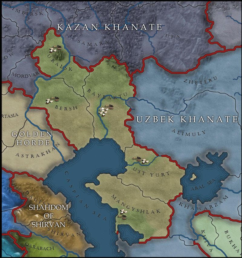
 
Last edited:
Because you don't need the same provinces to represent various era of history. The importance of regions changed. A region that's the focus of one game may be fairly minor in another. More: the games don't need the same amount of provinces. In CK2 they are feudal holdings. In EU3, they are the subdivisions of a state. In Victoria, they are economic regions. Victoria especially need more province, while I would argue that a 50% increase in EU3 would make the game tedious, by giving any sizeable countries far too many provinces to manage, to the point of overwhelming the player.

More, and still worse: it's already nearly impossible to divide the map into provinces that fit the entire EU era, and now you want them to split it into provinces that fit everything from 1066 to 1945? GIven how much borders have evolved, even with approximations, that's well-nigh impossible.

Besides which, this would require a Crusader Kings map of the whole world. That's a ludicrous undertaking - what, are we talking about researching polities for the entire world, including the Americas, in 1066 AD? Or are we instead looking at making all those regions empty, and completely outside the game - just a graphical waste of map resources?

Your proposal would do a number on gameplay and performance, and all for what? Easier to build converters?
 
Some of those provinces look really big, in particular those two huge provinces in australia so i'm assuming they cannot be colonised or explored, right? like permanent terra incognita?

I'm assuming they're large because of the time period making them difficult to traverse and leaving too little of interest (for EUIV) to split them up.
 
Besides which, this would require a Crusader Kings map of the whole world.
Worse: It would require a CK map of the whole world... with HoI province density.
 
Last edited:
Does anyone even use the default regional map constantly? I always use the political map
 
I make an observation, perhaps it's a little bit of regionalism but EU3 and Victoria maps have the same mistakes.

I can see two "lakes" in Quebec that aren't real lake. They are reservoirs, created by dams built in XXth century.

http://en.wikipedia.org/wiki/Robert-Bourassa_Reservoir
http://en.wikipedia.org/wiki/Manicouagan_Reservoir

It has absolutely no real consequences or impact on the game I know.

Mind, Manicouagan reservoir used to be two fairly sizeable lakes that were very close in size and shape to the modern lake. They just weren't joined together.