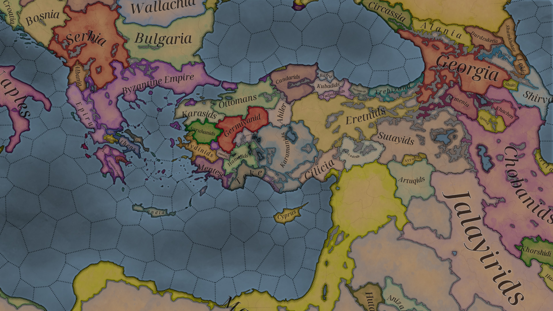
Todays Screenshot without Fog of War

  • We have updated our Community Code of Conduct. Please read through the new rules for the forum that are an integral part of Paradox Interactive’s User Agreement.
Apparently Ragusa isn't supposed to be owned by Venice? It's a pretty unique country so not having it would be kinda sad.
 
  • 11Like
Reactions:
What is with all the inconsistencies in beylik names? Why is it Germiyanid when all the other -id tags are in plural? Why is Menteşe treated different? And if it is Candar with c why is Tadjeddin with dj? I am okay with each and every one of these choices but I would like inner consistency.
 
  • 7
  • 3
  • 2Like
Reactions:
Very nice, though i'm not a fan of borders so thick and washy. I would prefer for them to be thiner and more distinct, like in eu4.

ss_0f31b85193b9e40fd70f710c0ac8fa843c96b604.1920x1080.jpg
 
  • 3
Reactions:
What is with all the inconsistencies in beylik names? Why is it Germiyanid when all the other -id tags are in plural? Why is Menteşe treated different? And if it is Candar with c why is Tadjeddin with dj? I am okay with each and every one of these choices but I would like inner consistency.
bunch of location names are inconsistently lettered aswell. beypazarı çankırı mihalıççık kıbrıscık nallıhan is correct but not polatli akyazi karapinar
söğüt niğde muğla meğri is correct but not emirdag egridir
akşehir beyşehir nevşehir şile balışeyh sarıyahşi şeyhli çerkeş is correct but not usak
İnönü İnegöl is correct but not Iznik Iskilip Izmit Iliç

i appreciate the addition of ğ ş ç ı İ. just apply it consistently and we are cool
kirpi.jpg
 
  • 5
  • 3
  • 1Like
Reactions:
Let me guess:
  • “Ottomans” is its vanilla country name.
  • “Jalayirids” is the dynasty dyn_countryname for IRQ
  • Every Turkish Beylik can rise like ottomans in OTL. If so, I’m wondering how to balance to grant Ottomans with more adnvantage. (Why not make TUR a formable tag huh)
 
Last edited:
  • 3
  • 1Like
  • 1
Reactions:
It still feels very dark. It's something that bothers me with CK3. V3 has a much brighter map.
 
  • 5
  • 2
  • 1
Reactions:
I would swap colors between Wallachia and Bosnia, and give Bulgaria a darker shade of green. Maybe swap colors between Albania and those Cephalonian islands.
Yeah, swapping Albania and Cephalonian Islands could work, Albania would then be very similar to HOI4 colour, just like Bulgaria. Not sure about swapping Bosnia and Wallachia though. Croatia is light green, wasn't it like that back in Victoria 2? Also, I don't like Epirus being purple, Naples, Byzantium and some other minors are already very similar in colour, I would prefer them to just keep EUIV's colour or Imperor: Rome's.
 
  • 1
Reactions:
Caucasus map is a confirmation that non-state tags are playable at release.

At least I am unaware of a Durduzuketia unified state in 1337.
 
Last edited:
I don't like the colours. It looks too... dirty? ill?
I prefer normal colours from CK2/EU4/Vic3 to the pseudo grimdark of a HOI4/CK3, but those ones are a cut above in terme of sleep inducing.
 
  • 8Like
Reactions:
Some feedback about the map:

1. To ensure that the land does not look as a floating paper over a distant plane of water, and ultimately so that they do not appear as differentiated entities, I would do the following:

- Draw the border with water, as a thin dark line and maybe a thin dark hatch in the land part of the limit (keep the colored border of the country color as it is, just to clarify).
- Replace the dark thick extended hatch, for a lighter blue thin shorter hatch at the coast in the water part of the limit.
- Slightly reflect the shallow coast, basins and deeps using lighter or darker water color.

This way, water and land look both as a unit map, not either floating over the other. The original is too much "float". Likewise, it improves visibility of small islands as i.e. the Aegean ones and takes advantage of the granularity of the map.

2. Furthermore, I would do the same operation in lakes, with the addition of also drawing the colored border of the country color as is seen in the border with impassable terrain. Right now, borders with lakes do not have any accentuation color of the respective country.

3. And finally, about water provinces shapes, I would make them all straight. I beg you Johan :). I find it bad mixing curved and straight lines.

I have drawn a sketch of all this, and I leave down here the original and suggested map to compare.

And lastly, a question if it can be answered; could we get a toggle to reflect slightly drawn borders of locations? Not only provinces, that I suppose are those present right now I can see in the map. I love the granularity seen in TT#4 and would love to slightly see the locations borders when at this zoom level.

Suggested.jpg

Original.png

The suggested map already feels to me way more granular, and of a bigger scale, just by removing the "float" effect. And those all straight sea lines are just pleasing after seeing the mixing of curved and straight in the original map.
 
Last edited:
  • 14Love
  • 9Like
  • 2
  • 1
Reactions: