• We have updated our Community Code of Conduct. Please read through the new rules for the forum that are an integral part of Paradox Interactive’s User Agreement.
Ober, you can check the beautiful map of Therion for better English/Latinized names alternatives as I doubt that anyone could make a better job here.

I talk with him quite often, so I do know the map. Anyway, I want to use simple English names, it's only vanilla extension after all.

I can help if you'll need any suggestion for PLC, Baltics, Scandinavia or the Low Countries

Suggestions are always welcomed, simply remmember that I don't want to entirely change the map, just to fix most horrific failures and add a few provinces that could actually benefit the game. ;)

At last it would be nice to redraw the borders in Lithuania as they are really somewhat crazy in vanilla.

Lithuania itself had to be made by someone evil in this map. But I have plans, once I'll get to do Magellan today I'll try merging with with Belarus, adding path to Baltic coast and then making Samigotia and Lithuania outta it. Seems reasonable, and in fact only thing requiring change there.
 
...
Looking at both maps they're quite similar, it seems that Qing only made more provinces outta it. Sadly, I can't find any Qing map in English :( Could you perhaps simply transliterate Qing provincional names to English? That'd help a lot ;)

Like that?
Qing_Dynasty_1820.png


I only checked the name in MyMap for any kind of reference. Should it be Breda then? Or perhaps Northern Brabant?

Breda would be the name of the major city and the province could be North Brabant like it´s nowadays:
https://en.wikipedia.org/wiki/North_Brabant

And either way, drawing something there is tricky, so I'll leave Zeeland for now. It's simply that Zeeland is usually a group is small islands and coast in other maps, and cutting that huge Zeeland now looks...silly. Perhaps southern Lowlands will require their borders slightly redrawn too, to match Netheralands.

If you look at the map I linked in my earlier post I would suggest that "Staats-Flanderen" (the northern part of Flandern that went to the Netherlands) should be lumped into the province of Zeeland. Staats-Flandern is too small for it´s own province and not being one of the 7 provinces too unimportant, so simply combining Zeeland+Staatsflandern into 1 province would be fine.

And Bremen-wise, should it be named Bremen or Verden? Now there's chance to change some names, so better be quick.

Few people outside Germany would now what Verden is. I would suggest Bremen (as the Bishopric of Bremen not the city of Bremen).
 
Last edited:
I talk with him quite often, so I do know the map. Anyway, I want to use simple English names, it's only vanilla extension after all.
Therion decided to go with English names in last version, just in more charming archaic 19th - early 20th centuries spelling. They are really nice IMO.

Suggestions are always welcomed, simply remmember that I don't want to entirely change the map, just to fix most horrific failures and add a few provinces that could actually benefit the game. ;)
Yep, I got the idea and style.

Lithuania itself had to be made by someone evil in this map. But I have plans, once I'll get to do Magellan today I'll try merging with with Belarus, adding path to Baltic coast and then making Samigotia and Lithuania outta it. Seems reasonable, and in fact only thing requiring change there.
Sounds good. I will think a bit, and will post some suggestions for you to consider.
 
In .psd everything looks a bit bigger...I can't really get dimensions right, guess I have to draw bigger provinces so that in game they look as I want.

Anyway, here's more or less how I wanted Samigotia to look like:

attachment.php


The problem is that other Baltic provinces are too long, so I'd have to make Kurland, Livland and Estland shorter (and then also same with Russia) to make Samigotia not look funny. Vilnius future is undecided, it surely won't remain like that. I thought of simply cutting off east and naming it Minsk. And maybe Grodno/Navahradak to south.

And what do you think of Samogitia. How does it look now? I am off to experiment some more (but not too much, I spent last two days playing with Magellan only lol :D) - it might be simply a matter of trying to get a hand on drawing provinces right.

@CD&Zweihander

Well, CD was faster but I see Zweihander did his job too. Since transliterated map is bigger, it'll be most helpful - I'll probably design new Chinese provinces around it, but they won't look the same - they'll be more round, vanilla style.
 
I'll take a look at China today later on, thanks Zweihander ;)

I'll use that map for sure.

That Samigotia looks crap, but I have an idea (I was just editing a post right now, damn this thread is lively!).

I'd move whole Lithuania to its more or less nowadays size, which would net us with nice looks, and three provinces - Lithuania, Navahradak and Minsk. The problem is, Teutons will be able to take their capital in war easily, and also that they won't be able to expand and take Samigotia to connect their Baltic possessions like they did just before FtG timeline.
 
...
That Samigotia looks crap, but I have an idea (I was just editing a post right now, damn this thread is lively!).

In your last post no image is shown?

I'd move whole Lithuania to its more or less nowadays size, which would net us with nice looks, and three provinces - Lithuania, Navahradak and Minsk. The problem is, Teutons will be able to take their capital in war easily, and also that they won't be able to expand and take Samigotia to connect their Baltic possessions like they did just before FtG timeline.

Deutscher_Orden_1410.png
 
I tried using attachments - so it doesn't work?

While none of these is really accurate, making provinces vanilla-style means that some provinces have to be a tad wrong to make it work. Okay, just in case :

Trier and Geneve (I might have something better for Trier):
bVPFSfn.png


Speaking of HRE screen, what would be more feasible: move Mainz a bit more to south (so it'd take part of Baden not Wirtemberg - silly) or east (Wurzburg)? Currently Trier and Pfalz are other way round, as Heidelberg was at the other side of Rhine and it should be where Mainz is. Then Trier would come in place of Pfalz and there's be no need for cutting out small, weird province there.

But how far east can Mainz go?

Samigotia (although again I have better idea, gotta try it out):
bYFS5bJ.png


For now I killed Memel and more or less split between Prussia and Samigotia. Maybe Prussia could receive province from its southern part (Thorn could work), but that might be too small.


That's exactly what I was worrying about - Europe is broken to the point where I'd have to add completely broken provinces to make it work. While Asia isn't problem because Korea, China or Japan require complete overhaul as Paradox setup is crap, I don't want to end up more or less redrawing Europe. Maybe in distant past, but not now.

Although maybe it doesn't look bad. I just somehow sometimes can't look at anything I've done. Hence why I require someone else to check and share his opinion.
 
Okay, reworked that Lithuania a bit. Now, how does that look?

okxkpIp.png


While I still dislike border between Prussia and Samigotia, I believe it's a good starting point right?

I'm also afraid font will have to be changed, since I can't find Bernhard Modern True Type (which is what was used for EU2).

Time to take short break, I can't spend rest of my life in Magellan :D And then I'll work on China.
 
...
Speaking of HRE screen, what would be more feasible: move Mainz a bit more to south (so it'd take part of Baden not Wirtemberg - silly)

Moving Mainz more south is only an option if you won´t split Baden into Breisgau (south of current Baden) and Baden (north of current Baden).

... or east (Wurzburg)? Currently Trier and Pfalz are other way round, as Heidelberg was at the other side of Rhine and it should be where Mainz is. Then Trier would come in place of Pfalz and there's be no need for cutting out small, weird province there.

But how far east can Mainz go?

Moving Mainz east could be justified because "Kurmainz" actually ruled areas more east around Aschaffenburg:
https://de.wikipedia.org/wiki/Kurmainz#Das_Gebiet_des_Kurf.C3.BCrstentums_und_des_Erzbistums_Mainz
HRR_1648.png

BUT the city of Mainz itself is located directly next to the river rhine so the province and it´s capital should at least touch the Rhine at one point.
 
That Samigotia looks crap, but I have an idea (I was just editing a post right now, damn this thread is lively!).

I'd move whole Lithuania to its more or less nowadays size, which would net us with nice looks, and three provinces - Lithuania, Navahradak and Minsk. The problem is, Teutons will be able to take their capital in war easily, and also that they won't be able to expand and take Samigotia to connect their Baltic possessions like they did just before FtG timeline.
I think you can block path between Prussia and Courland in game files. But I do not think that if there ever had been such necessity for the Teutons to move their army from Prussia to Livonia in the 15th-16th centuries reality anyone would give a damn about borders "sovereignty" of this tiny bit of Palanga coast.:)

I made a drawing of the area. There are mostly only geographic corrections, because as you could see the geography in Eastern Europe is really wrong. Seriously, even Moscow was in wrong place.:blink: Most of the "new" provinces are just replacements for vanilla ones (in general there are only 2 or 3 completely new probably). I decided not to add Minsk (as it would be too many balance-wise), but Grodno (Sudovia) instead to secure Lithuania from Prussia as you mentioned this issue.
 
Okay, reworked that Lithuania a bit. Now, how does that look?...

If possible the coast that Lithuania controls should be a very short part, e.g. as here:
Lithuanian_state_in_13-15th_centuries.png

so that Prussia and Kurland almost touch.

Is it possible to make a change to Prussia so that it won´t look like "russia" because the capital covers the "P"?
 
@CD

While that's indeed true, I just want to adhere to vanilla style and keep provinces away from being too detailed. Although seeing how badly broken vanilla map is and how you guys are pressing so hard with nicely detailed maps fro web I'm afraid we'll end up redrawing whole vanilla map, which maybe wouldn't be a terribly bad idea, but it could take too much time and finished map would be more similar to MyMap than vanilla.

Names there are temporary, I just put them to mark provinces right. Either way, that circle indicating stability(?) is always placed where city building is, and since I wasn't playing with coordinates yet (and I won't until all changes will be ready) it'll be like that for now. Playable version will have it sorted. ;)

@HD

With skills and knowledge of this magnitude, why you sire won't make a map on your own? I struggle to draw one province and you made whole Russland in one go. :O

However, while all provinces look nice, let me point it again - vanilla style. I only hope to expand map a bit and add some depth to gameplay. Your map sire looks like a completely new project, and thou it's perfectly accurate indeed, it's simply far from being vanilla map.

My point in expanding vanilla map is that most people are playing vanilla, and after some lifting expanded vanilla could become a new standard for most players (I hope so at least). If we are to make something different, let's wait for a second and decide what do we really want to achieve. I only hoped for some crucial fixes and minor additions, but if everyone wants to go with something new or transform vanilla even more, I have no problem with that.

Let's simply decide now what we really want, before too much work will go to waste.
 
With skills and knowledge of this magnitude, why you sire won't make a map on your own? I struggle to draw one province and you made whole Russland in one go. :O
After all the months spent and tons of sources watched helping Therion's project, this was not the issue.;)

However, while all provinces look nice, let me point it again - vanilla style. I only hope to expand map a bit and add some depth to gameplay. Your map sire looks like a completely new project, and thou it's perfectly accurate indeed, it's simply far from being vanilla map.

My point in expanding vanilla map is that most people are playing vanilla, and after some lifting expanded vanilla could become a new standard for most players (I hope so at least). If we are to make something different, let's wait for a second and decide what do we really want to achieve. I only hoped for some crucial fixes and minor additions, but if everyone wants to go with something new or transform vanilla even more, I have no problem with that.

Let's simply decide now what we really want, before too much work will go to waste.
Well, I tried to imitate the vanilla "fragmented" and blurish style. So the borders are not that "accurate" really.:)
This is just suggestion, so you can at last orient geography-wise on the drawing, constructing your Russian setup because most of the provinces here are terribly misplaced in vanilla.
 
I guess it is simply that I wanted to only fix vanilla map at first a bit, even if inaccurate it's quite charming.

Only issue about map you've provided is only that...it's still too accurate. Of course, we could go for something like that, no problem, only that PV map already has most of stuff done - only drawing borders is left.

I made that "Vanilla FtG" thread only to see how much people are playing it, so I could estimate if it's worth trying to expand or create new mods/maps from scratch. And actually many people seem to play vanilla and have fun with it. But I, same as you guys, simply cannot accept vanilla's madness, not all of it anyway.

Some can be fixed, but if we'll change it too much, no one will ever play it and everyone will return to basic vanilla. That's the problem for me. Trying to keep that feeling desperately.
 
Okay, reworked that Lithuania a bit. Now, how does that look?

okxkpIp.png


While I still dislike border between Prussia and Samigotia, I believe it's a good starting point right?

I'm also afraid font will have to be changed, since I can't find Bernhard Modern True Type (which is what was used for EU2).

Time to take short break, I can't spend rest of my life in Magellan :D And then I'll work on China.

fine, very good...completed
 
If possible the coast that Lithuania controls should be a very short part, e.g. as here:
Lithuanian_state_in_13-15th_centuries.png

so that Prussia and Kurland almost touch.

Is it possible to make a change to Prussia so that it won´t look like "russia" because the capital covers the "P"?

does the size of gap matter, 10k, 50k or 100k wide makes no difference, there was NO set borders in those days unless rivers where involved
 
Last edited:
Free Cities
by Mad King James

There is room for Ragusa, but Ragusa is not a "state", it is a free city. Free cities (IE cities under the protection of a larger state, but engaging in independent commerce) are everywhere. If we impliment Ragusa, then why not Danzig, Hamburg, Lubeck, Nuremburg and Bremen, all of which were more important?

I'll tell you why we don't, because they do crazy things like invade other states, build gigantic armies, secure royal marraiges, and basically don't act like free cities.

Basically all free cities had no army. None. They had a garrison of perhaps a thousand to man the fortress. Also they were all technically under a larger kingdom, and were a lot more of a vassal than a "vassal" is in the game. Ragusa for instance was part of the Kingdom of Bosnia. When the kingdom of Bosnia fell to the Ottoman Empire they became part of the Ottoman Empire, simply by virtue of the fact that Bosnia had fallen to them, and they quite graciously allowed them to maintain their free city status. Lubeck and Hamburg were free Imperial cities under the Emperor, even during the Thirty Years War this status never changed, they just became "Protestant Free Cities of the Holy Roman Empire".

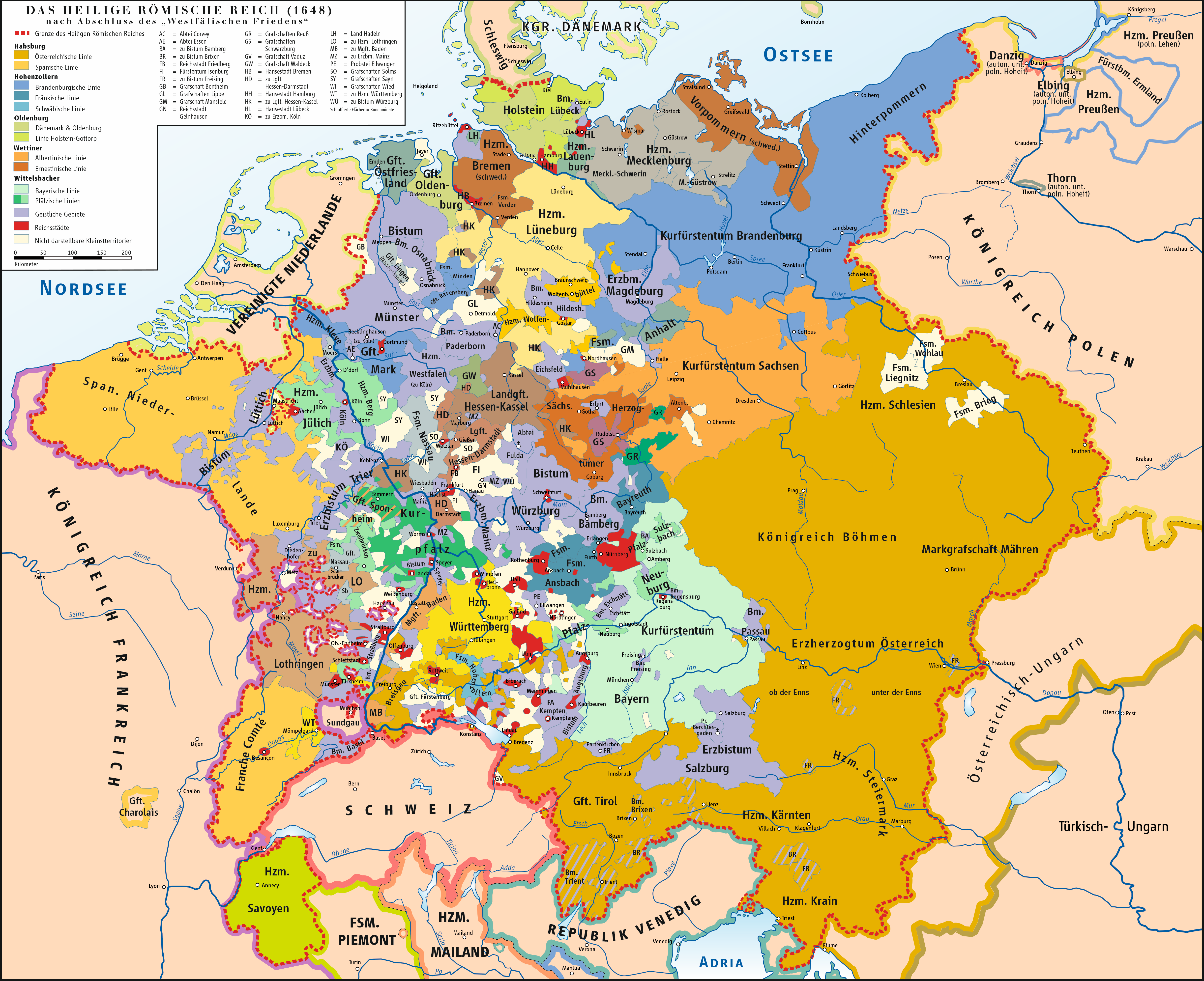
Danzig, same deal, different king, this time Poland.

At no time did Ragusa for instance "offer" to be an Ottoman vassal, the "offer" was basically just admitting that their kingdom had fallen to the Ottoman Empire and that they were their new overlords, and the Ottomans nodding and not revoking their free city status (which they easily could have done had they not done this).

If Ragusa had not been a free city, and rather a city-state (like Venice) it would have been invaded by Venice the first time they turned their back. The only reason this did not occur is Venice didn't want to take on the entire Kingdom of Bosnia (who would take a dim view of Venice invading one of his cities, even a semi-autonamous one).

-----------------------------

I have read above from the Agceep website, so what about Bremen? Is Bremen also a free city? Perhaps we should change Bremen to another country.

there is no Room for ragusa, Venice kept it alive to deal with the ottomans to trade Venetian goods when the pope advised Venice not to deal with the Ottomans.
Later Venice built up Spoleto to deal directly with the ottomans in trade. and ragusa died out..........it was the last place where the ancient dalmatian language was spoken and renamed in 1918 to dubrovnik...........so slavs can "claim" it

There is no gameplay for ragusa........if you do not want to make it something else , then merge it into bosnia