• We have updated our Community Code of Conduct. Please read through the new rules for the forum that are an integral part of Paradox Interactive’s User Agreement.
Finally it W-O-R-K-S !!! :cool:

Here are the problems that I had when making this map run (thanks a lot to Cool-toxic for his help):

Crashes when scrolling to PTI
- red border lines was overlapping over PTI ID

Crashes when zooming out
- during scaling down when importing to EU2 (using /L option), some border lines got over PTI ID on the down scaled lightmaps

Units can't move
- in EU2MAP was missing rivers' terrain informations (terrain value 6) from province.csv

Coastal provinces has port, but bay is not displayed in city view
- province is set as "coastal", but sea/port adjacency is still missing

Units can't board the fleet even from coastal provinces
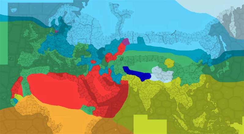
- sea zones require "Area" to be set as "Sea"
- to be sure I set also "Region" and "Continent" values


Most "province.csv" informations can be set after importing to EU2. This doesn't pay for rivers! Rivers need "Terrain" to be set to value 6 and have this information in EU2MAP already during importing from PSD.
And it's good to use MIMAGE with /G:3 option during importing from PSD to EU2MAP if the map is made from blank :D

...

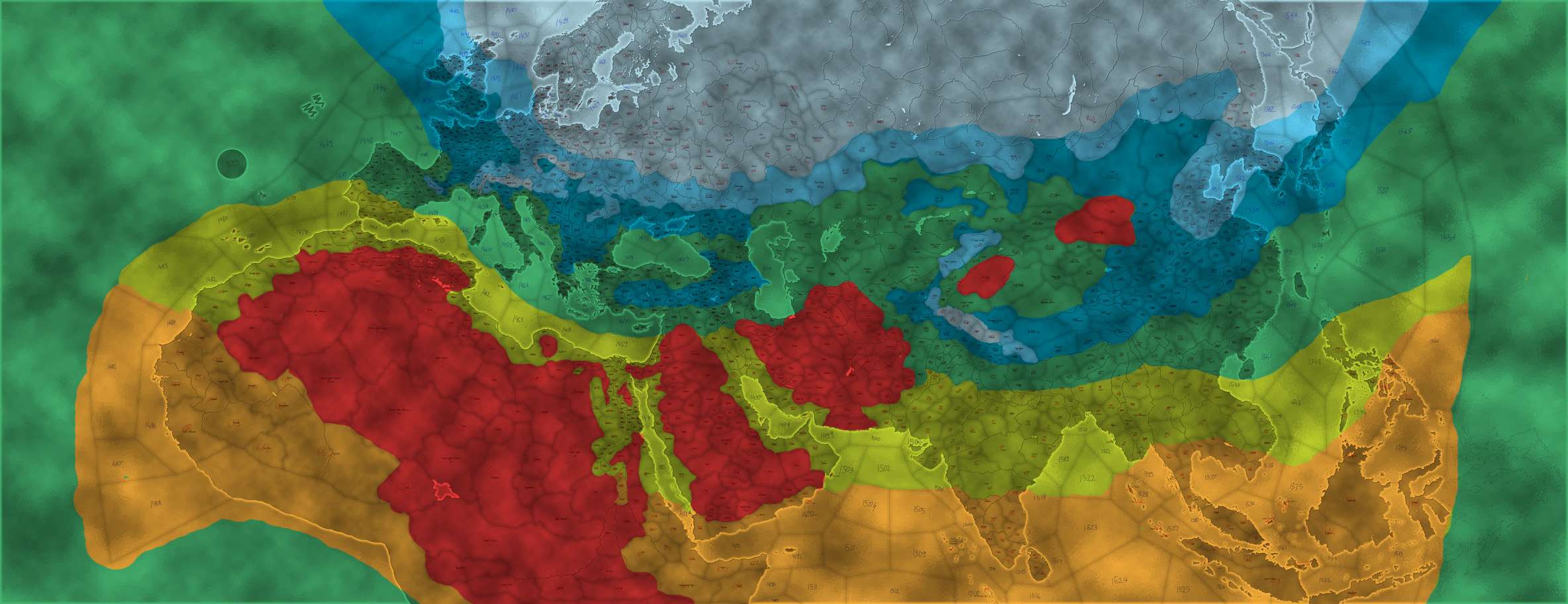
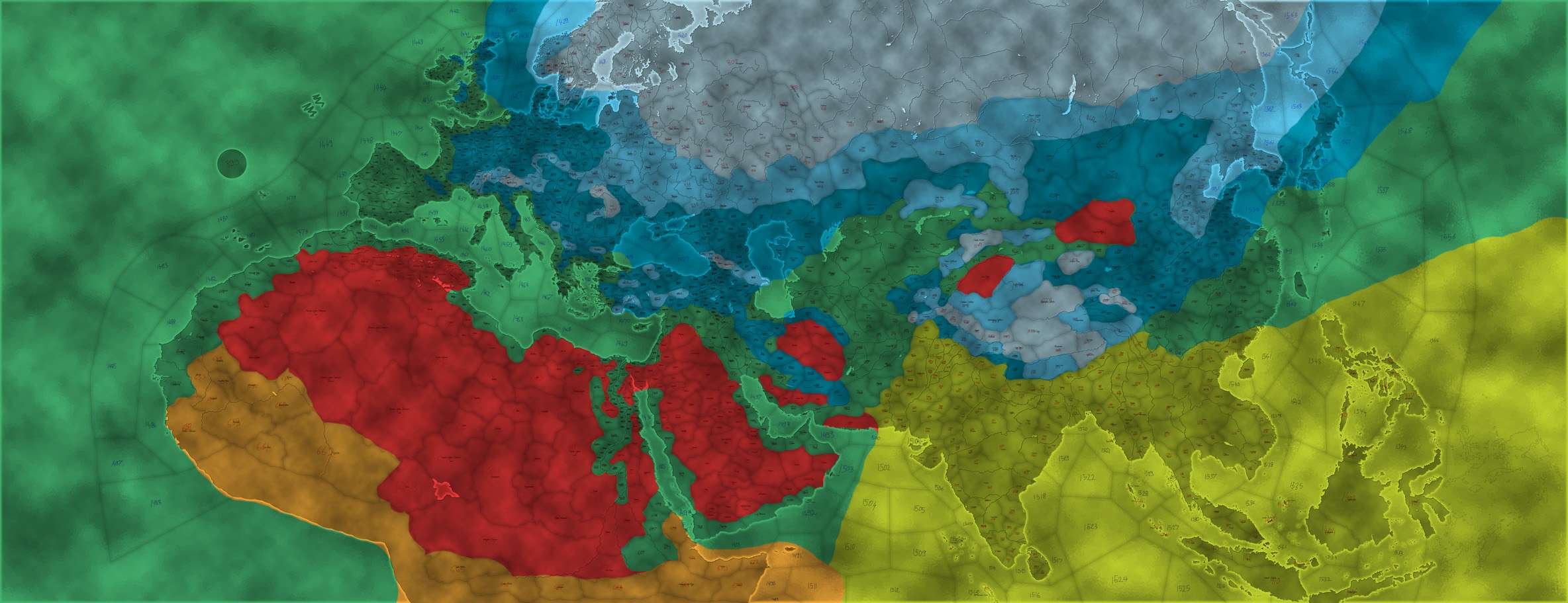
So now I'll quickly set few countries and will kick the Alpha version on-line ;)


It's ALPHA and a lot of things are still missing for the provinces (like terrain :D ). I'll be releasing updates with new stuff in the future.
If you want incorporate this map in your mod, you need take from Ptolemy World Map:

- whole Map folder
- file DB\Province.csv
- file DB\straits.csv
- file Gfx\Map\MinimapEmpty.bmp
- file Gfx\Map\Minimapfull.bmp

All other stuff is for testing scenario.
 
Does somebody know how to cancel adjacency through adj-defs.csv?

Say, I have SeaZone1, SeaZone2 and Province3.
Magellan set adjacencies SeaZone1-Province3 and SeaZone2-Province3.
I however need to remove the adjacency SeaZone2-Province3, because these are bordering just with their corners.
Is there some way to delete this adjacency through adj-defs.csv? Something like this?
Code:
2;3;none;0;comment
 
i think i will just wait until the mod is fully playable(countries, time historical setting, etc)
but looks VERY promising already:)
Thanks. Full historical mods with Ptolemy World Map will be Roma Universalis and The Odyssean World ;)

It looks great. Would it be ok if I used this map for my mod?
It's free as the air :)
Looking forward to see your Odyssean World in new environment.
 
Does somebody know where is the table with climatic values?
I remember a table where was values of climate and a description (like snow is there from-to, etc.)
I somehow can't however remember where it was. I looked in Havard's bible, Eu2 Wiki, stickied sources, FAQ, but can't find it again :(

EDIT:
Found it :D
It's hidden in Havard's bible.
Access available only through a secret corridor :D
 
Last edited:
Ah, thanks :)
That's a useful page.

Now, I need some revision on climate from few people who might be interested.
I drew this climatic design, but I have no historical informations about weather in ancient times, so I drew it by my fantasy.
Ideas and opinions are welcomed. Confront this design with your own knowledge or opinions about weather in centuries before Christ.

Please, look at it in detail, if you'll do. Roughly I have an idea that somewhere here should be snow or somewhere here tropical lands,
but now it is about provinces - whether the border between 3months snow and 5months snow (just an example) should be here, or by one province more to north, etc.
Thanks for any help, idea and opinion.

Colors legend:
Snow - 8 months: October - May
Snow - 5 months: November - March
Snow - 3 months: December - February
No snow
Tropical
Tropical (equatorial)
Desert - dry hot weather, not necessarily desert as terrain

climatep.jpg
 
Movement penalty, check vanilla province.csv. Many if not all seazones are artic. Fodoron tweaked climate values for seasones in order to implement currents in AGCEEP.
 
I think that only much smaller part of Iran should be a desert
 
YodaMaster >> I wonder when I will finally learn: "When you don't know, look at vanilla." :D
So vanilla uses sea-zones with climate 0 (most of them), and few with climate 5 and 7 (arctic seas).
Vanilla also showed interesting thing (at least for me) about climate 4 and climate 6.
4 seems to be forest-tropical, and 6 a savanna-tropical climate. So far it looks from their separation on India (4), and Africa (6).
A bit strange is then however Kongo, where are tropical forests, but have still climate 6 which I would say means savannas. :wacko:
Also surprising is climate 8 in Himalaya :eek:

Vanilla LAND climates in Europe, Asia, and northern half of Africa:
(sea-climates not included, climatic borders over sea are only as guide-lines)
climatevanilla.jpg


elvain >> Oh, thanks. That's why I wanted people review it ^___^
Somehow I had fixed in my head that Iran means desert. I forgot on all those mountains :D

So here is an update of climates' design. I did a bit more changes:
- smaller arctic region in Europe
- less snow in Britain
- no snow on coast of France
- corrected tropical climates 4 and 6 according the Vanilla
- bit more snow in Caucasian Mountains and Asia Minor
- less desert in Iran (added some snow climate according vanilla)
- more snow in Tibet
- better snow model of whole Tchien-Shan - Himalaya - Kuen-Lun system

Colors legend:
Snow - 8 months: October - May
Snow - 5 months: November - March
Snow - 3 months: December - February
No snow
Tropical (forests?)
Tropical (savanna?)
Desert - dry hot weather, not necessarily desert as terrain

climate2.jpg