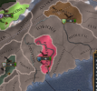
Hey everyone! Today is the last day of us talking about the native americans and the rework they are getting. We’ll be talking about the changes to the Federations and the new world setup. As you’ll see on the pictures for the map, a lot of tags have been split up in order to represent federations properly. A prime example is the Iroquois who will now be several tags and start in a federation at game start.
So let’s start with how to form them. Since we are splitting up the federal tags like the Huron and Iroquois I still wanted to retain some kind of identity for them. As such when you invite the first member to form a federation with you, you get the opportunity to also name the Federation. There are some default options scripted that can be based on Tags and Cultures which it will suggest for you, but you can of course just write whatever you want here.

We’ve also redone how leadership of the federation is decided. It is no longer decided on the death of the monarch of the leader in the tribe, instead we measure a cohesion value of the Federation. This value changes each month depending on the composition of the Federation but also some external factors. Keep in mind that any numbers & values are work in progress!

If cohesion hits 0% then it will trigger a change in leadership. In order to keep the cohesion high you want to keep similar cultures within your federation, however having one or two of a separate culture group won’t really be problematic. Another source of loss of cohesion is also if there are members that are stronger than the leader. For later in the game to help you keep a large federation together, if you have any colonizers on your border it will help you keep it together by having an external threat increasing your cohesion.
If a leadership change is triggered it will try to pick the strongest member to be the new leader, if the leader is the strongest then the federation will be disbanded. This entire process is 100% done in script, from calculation of members strength to what happens during leadership change. Currently for testing the strength is calculated from the max manpower of members and is done as a scripted function with an effect and looks like this:
Here’s the current list of values that affect your cohesion
The aim here is to make Federations more something you can count on, instead of having to try and keep your prestige high or stack diplomatic reputation at all times just in case your leader at some random point dies, you can now count on it instead and try to plan around what you need to do in order to keep the leadership position.
Now I’m going to hand it over to a member of our beta program. @Evie HJ who have done the excellent work of reforming North America’s setup making it a much more vibrant and interesting place.
It's a whole (new) New World we live in
The setup for North America hasn’t really changed much at all since the release of Art of War, almost ix years ago – and, as far as the list of playable countries is concerned, since Conquest of Paradise even earlier. The new changes to the Native game mechanics in this patch provided a perfect opportunity to take a new look at a region that has remained largely untouched for a long time.
In some ways, this overhaul is our most ambitious review of the North American setup to date. The province count does fall short of Art of War (though fifty-three new provinces, not counting wastelands, is nothing to sneeze at), but the list of new tags is more than we ever added to North America at any single time. In fact, with fifty-six new tags, we’re adding more North American tags in this one overhaul than we have in the entire history of the Europa Universalis franchise.
Those tags are not evenly spread out across the continent. Two regions (the South-East United States and the Great Lakes and Saint Lawrence) get the lion’s share of the tags. Others like the Great Plains or Hudson Bay, get a handful of provinces or tags. The West Coast, for its part, where we know almost nothing of Indigenous people before the last century or so of the game, was entirely outside the scope of this overhaul. This applies to the provinces as well as the tags: in broad terms, we tried to add provinces in the same general region we were adding tags, to keep the amount of empty (or tribal land) provinces roughly similar.
With twenty-one new tags, it is the South-East United States that receive the most work in this new overhaul. The reason is simple: up until now, the 1444 setup in the game represented the historical situation around 1600-1650. The first 150 years of the game – a time when the last great cities of the Mississippian civilizations flourished in the region (the more northern city, like Cahokia, were likely abandoned by 1444)– were left out entirely. This was the first thing we set out to fix, and the new setup, as a result, emphasize the situation that early European explorers and archaeologists tell us about – not English colonists two centuries later. By and large, most of those new tags are settled nations, and (except the Cherokee) all belong to the Muskogean culture group. This is a compromise for some of them: while they spoke Siouan languages like Catawba, they were heavily influenced by the Southern Appalachian Mississippian culture, and it’s those cultural ties we chose to emphasize.

In the new setup, the Creek Confederacy is no longer available at game start, and the Cherokee are reduced to a one-province statelet in the mountains. In their stead, the Coosa Paramount Chiefdom is now the major power of the region. Though a one-province nation in itself, it rules through a network of subject states (Satapo, an area stretching from the Kentucky border to Alabama along the spine of the Appalachians. Surrounding it are a number of smaller, independent chiefdoms, including both sites visited by the De Soto expedition (Altamaha, Cofitachequi, Joara, Ichisi, Chisca, as well as Atahachi, the future home of Chief Tuscaloosa) and of Muskogean towns that would eventually form the seeds of the future Creek Confederacy, like Coweta and Kasihta. Further west, in the valleys of the Mississippi, they are joined not only by more of the chiefdoms documented by De Soto, (Quizquiz, Anilco, Pacaha and Casqui, the last three corresponding to the Menard-Hodges, Nodena and Parkin Mound archaeological sites), but also by the Natchez people, who would, in later century, become the last tribe to embrace Mississippian culture.
Further north, our other focus region was the Great Lakes of North America. Here, the main concern was nothing to do with our setup representing the wrong date (except along the Saint Lawrence, where the Iroquoians of the sixteenth century were mysteriously missing), and everything to do with the fact that the two most famous (con)federations of natives, the Hurons and Iroquois, were represented as monolithic nations with no use for the in-game Federation mechanism. Once it was decided to represent each of the nations making up those two confederations independently, adding in the other relevant nations in the region was an obvious choice. As with the United States South-East, these are largely settled nations of Iroquoian cultures, although a handful of them are migratory instead.

This gives us a sizeable five new nations where the one Iroquois tag used to be: Mohawk, Oneida, Onondaga, Cayuga and Seneca (plus, starting much further south at game start but not forgotten, the Tuscarora). Opposing them are the less well-known member nations of the Huron Confederacy: Tahontaenrat, Arendaronon, Attignawantan and Attigneenongnahac. In addition to them, we have a selection of minor Iroquoian nations that can struggle to strike the right balance to remain neutral between these two powerful Confederacies. This notably include the aptly named Neutral Nation (Attiwandaron), as well as the Tionontate (or Tobacco Indians), the Wenro of far western New York, and the Erie of Northwest Pennsylvania (plus the already existing Susquehannock). As the last two (Erie, Susquehannock) represent nations that claimed large territory but with very little united government, they are represented as migratory nations. You can think of the migration as representing shifting balance of power among the different villages and groups of their respective nations, rather than actual physical relocation. Also represented as migratory are the first two Iroquoian nations ever encountered by European: Stadacona, on the site of present day Quebec City, and Osheaga (Hochelaga), in present Montreal. In their case, leaving them migratory was the simplest way to enable them to potentially vanish from the Saint Lawrence lowlands, as they did in the late sixteenth century.
Our changes didn’t stop at those new areas, though they received the bulk of the changes. Existing tags that represented larger confederations or culture group were split into (some of) their constituent parts: the Illinois are now represented by the Kaskaskia, Cahokia and Peoria, the Shawnee by Chalahgawtha, Kispoko and Hathawekela, and the Puebloan people expanded from Keres and Pueblo to Acoma, Zia, Ohkay Owingeh and Sandiat. In a similar vein, some particularly large groups that used to be represented by a single tag now have additional tags to represent them: this is the case of the Cree, with the addition of the Nehiyaw (Plains Cree) nation, the Ojibwe, who are now additionally represented by the Mississage for their easternmost group and the Nakawe (or Saulteaux) for their western bands, and the Sioux, now expanded to include the Wichiyena (Western Dakota) and Lakota nations. Historical confederations that were lacking some of their members or needing a boost also gained it: the Iron Confederacy gained the Nehiyaw and Nakawe, described above; the Three Fires now add the Mississage to their alliance, and the Wabanaki Confederacy of North-East North America can now count on the help of the Maliseet and Penobscot as well as the pre-existing Abenaki. Finally, three more tags are added on sheer account of their historical importance in the Colonial era, two as allies of New France, one as ally-turned-enemy of New England: the Algonquin of the Ottawa valley, the Innu of the Gulf of Saint Lawrence, and the Wampanoag of Massachusetts Bay.

Along with all these changes, we finally introduced Wasteland mountain ranges to North America. Not in the Rockies (where the handful of connections already represent major passes through the mountains), but rather, in the East, along the Appalachian mountains. While they may not seem like much today, they were formidable obstacle to westward expansion in colonial time, when it was said that there were only five paths from the East Coast westward that could be taken by large groups of people: around the mountains to the south in the Piedmont of Georgia, through the Cumberland gap on the border of Virginia and Tennessee, through the Cumberland Narrows of western Maryland, the Allegheny gaps of Pennsylvania, and finally through the valley of the Mohawk river, in New York. In addition, through it didn’t allow for east-west travel per se, the Great Valley of the Appalachians was another significant route through the region, running from Alabama to Pennsylvania. All of them are now represented in the game, along with the mountains that bordered them.
We also tried to adopt a somewhat consistent standard in the naming of provinces, and revise province names accordingly. The new standard prefers the self-given names of a Native group (tribe, nation, band…) who lived in the region where we can find one. If none can be found, other options include a name given to a local people by a neighboring tribe (provided it’s not derogatory), or a geographic name in a local Native language. In all cases, we now tend to favor native spelling where we are able to find it, though symbols that are particularly unusual in the standard Latin Alphabet may be set aside or approximated for our players’ benefit.
That’s it for today, as usual I’ll answer questions in the thread however there’s one I want to address yet again as it keeps getting asked and I can’t answer every single time it gets asked. People have asked if these features will be applied to South America or the Siberian Natives etc. It all depends on time, the main focus is to rework the North Americans and if I have time I will make sure it plays nice with others that can also benefit but it is not a priority. Next week will have it’s development diary written by Johan.
So let’s start with how to form them. Since we are splitting up the federal tags like the Huron and Iroquois I still wanted to retain some kind of identity for them. As such when you invite the first member to form a federation with you, you get the opportunity to also name the Federation. There are some default options scripted that can be based on Tags and Cultures which it will suggest for you, but you can of course just write whatever you want here.
We’ve also redone how leadership of the federation is decided. It is no longer decided on the death of the monarch of the leader in the tribe, instead we measure a cohesion value of the Federation. This value changes each month depending on the composition of the Federation but also some external factors. Keep in mind that any numbers & values are work in progress!
If cohesion hits 0% then it will trigger a change in leadership. In order to keep the cohesion high you want to keep similar cultures within your federation, however having one or two of a separate culture group won’t really be problematic. Another source of loss of cohesion is also if there are members that are stronger than the leader. For later in the game to help you keep a large federation together, if you have any colonizers on your border it will help you keep it together by having an external threat increasing your cohesion.
If a leadership change is triggered it will try to pick the strongest member to be the new leader, if the leader is the strongest then the federation will be disbanded. This entire process is 100% done in script, from calculation of members strength to what happens during leadership change. Currently for testing the strength is calculated from the max manpower of members and is done as a scripted function with an effect and looks like this:
Code:
calculate_federation_member_strength = {
    effect = {
        export_to_variable = { which = our_manpower value = max_manpower who = THIS }
        set_variable = { which = federation_strength which = our_manpower }

    }
}
Here’s the current list of values that affect your cohesion
- -1 For every member not of leaders culture group
- +1 For every member of leaders culture group
- -1 For every member stronger than the leader
- +1 for neighboring hostile Europeans
The aim here is to make Federations more something you can count on, instead of having to try and keep your prestige high or stack diplomatic reputation at all times just in case your leader at some random point dies, you can now count on it instead and try to plan around what you need to do in order to keep the leadership position.
Now I’m going to hand it over to a member of our beta program. @Evie HJ who have done the excellent work of reforming North America’s setup making it a much more vibrant and interesting place.
It's a whole (new) New World we live in
The setup for North America hasn’t really changed much at all since the release of Art of War, almost ix years ago – and, as far as the list of playable countries is concerned, since Conquest of Paradise even earlier. The new changes to the Native game mechanics in this patch provided a perfect opportunity to take a new look at a region that has remained largely untouched for a long time.
In some ways, this overhaul is our most ambitious review of the North American setup to date. The province count does fall short of Art of War (though fifty-three new provinces, not counting wastelands, is nothing to sneeze at), but the list of new tags is more than we ever added to North America at any single time. In fact, with fifty-six new tags, we’re adding more North American tags in this one overhaul than we have in the entire history of the Europa Universalis franchise.
Those tags are not evenly spread out across the continent. Two regions (the South-East United States and the Great Lakes and Saint Lawrence) get the lion’s share of the tags. Others like the Great Plains or Hudson Bay, get a handful of provinces or tags. The West Coast, for its part, where we know almost nothing of Indigenous people before the last century or so of the game, was entirely outside the scope of this overhaul. This applies to the provinces as well as the tags: in broad terms, we tried to add provinces in the same general region we were adding tags, to keep the amount of empty (or tribal land) provinces roughly similar.
With twenty-one new tags, it is the South-East United States that receive the most work in this new overhaul. The reason is simple: up until now, the 1444 setup in the game represented the historical situation around 1600-1650. The first 150 years of the game – a time when the last great cities of the Mississippian civilizations flourished in the region (the more northern city, like Cahokia, were likely abandoned by 1444)– were left out entirely. This was the first thing we set out to fix, and the new setup, as a result, emphasize the situation that early European explorers and archaeologists tell us about – not English colonists two centuries later. By and large, most of those new tags are settled nations, and (except the Cherokee) all belong to the Muskogean culture group. This is a compromise for some of them: while they spoke Siouan languages like Catawba, they were heavily influenced by the Southern Appalachian Mississippian culture, and it’s those cultural ties we chose to emphasize.
In the new setup, the Creek Confederacy is no longer available at game start, and the Cherokee are reduced to a one-province statelet in the mountains. In their stead, the Coosa Paramount Chiefdom is now the major power of the region. Though a one-province nation in itself, it rules through a network of subject states (Satapo, an area stretching from the Kentucky border to Alabama along the spine of the Appalachians. Surrounding it are a number of smaller, independent chiefdoms, including both sites visited by the De Soto expedition (Altamaha, Cofitachequi, Joara, Ichisi, Chisca, as well as Atahachi, the future home of Chief Tuscaloosa) and of Muskogean towns that would eventually form the seeds of the future Creek Confederacy, like Coweta and Kasihta. Further west, in the valleys of the Mississippi, they are joined not only by more of the chiefdoms documented by De Soto, (Quizquiz, Anilco, Pacaha and Casqui, the last three corresponding to the Menard-Hodges, Nodena and Parkin Mound archaeological sites), but also by the Natchez people, who would, in later century, become the last tribe to embrace Mississippian culture.
Further north, our other focus region was the Great Lakes of North America. Here, the main concern was nothing to do with our setup representing the wrong date (except along the Saint Lawrence, where the Iroquoians of the sixteenth century were mysteriously missing), and everything to do with the fact that the two most famous (con)federations of natives, the Hurons and Iroquois, were represented as monolithic nations with no use for the in-game Federation mechanism. Once it was decided to represent each of the nations making up those two confederations independently, adding in the other relevant nations in the region was an obvious choice. As with the United States South-East, these are largely settled nations of Iroquoian cultures, although a handful of them are migratory instead.
This gives us a sizeable five new nations where the one Iroquois tag used to be: Mohawk, Oneida, Onondaga, Cayuga and Seneca (plus, starting much further south at game start but not forgotten, the Tuscarora). Opposing them are the less well-known member nations of the Huron Confederacy: Tahontaenrat, Arendaronon, Attignawantan and Attigneenongnahac. In addition to them, we have a selection of minor Iroquoian nations that can struggle to strike the right balance to remain neutral between these two powerful Confederacies. This notably include the aptly named Neutral Nation (Attiwandaron), as well as the Tionontate (or Tobacco Indians), the Wenro of far western New York, and the Erie of Northwest Pennsylvania (plus the already existing Susquehannock). As the last two (Erie, Susquehannock) represent nations that claimed large territory but with very little united government, they are represented as migratory nations. You can think of the migration as representing shifting balance of power among the different villages and groups of their respective nations, rather than actual physical relocation. Also represented as migratory are the first two Iroquoian nations ever encountered by European: Stadacona, on the site of present day Quebec City, and Osheaga (Hochelaga), in present Montreal. In their case, leaving them migratory was the simplest way to enable them to potentially vanish from the Saint Lawrence lowlands, as they did in the late sixteenth century.
Our changes didn’t stop at those new areas, though they received the bulk of the changes. Existing tags that represented larger confederations or culture group were split into (some of) their constituent parts: the Illinois are now represented by the Kaskaskia, Cahokia and Peoria, the Shawnee by Chalahgawtha, Kispoko and Hathawekela, and the Puebloan people expanded from Keres and Pueblo to Acoma, Zia, Ohkay Owingeh and Sandiat. In a similar vein, some particularly large groups that used to be represented by a single tag now have additional tags to represent them: this is the case of the Cree, with the addition of the Nehiyaw (Plains Cree) nation, the Ojibwe, who are now additionally represented by the Mississage for their easternmost group and the Nakawe (or Saulteaux) for their western bands, and the Sioux, now expanded to include the Wichiyena (Western Dakota) and Lakota nations. Historical confederations that were lacking some of their members or needing a boost also gained it: the Iron Confederacy gained the Nehiyaw and Nakawe, described above; the Three Fires now add the Mississage to their alliance, and the Wabanaki Confederacy of North-East North America can now count on the help of the Maliseet and Penobscot as well as the pre-existing Abenaki. Finally, three more tags are added on sheer account of their historical importance in the Colonial era, two as allies of New France, one as ally-turned-enemy of New England: the Algonquin of the Ottawa valley, the Innu of the Gulf of Saint Lawrence, and the Wampanoag of Massachusetts Bay.
Along with all these changes, we finally introduced Wasteland mountain ranges to North America. Not in the Rockies (where the handful of connections already represent major passes through the mountains), but rather, in the East, along the Appalachian mountains. While they may not seem like much today, they were formidable obstacle to westward expansion in colonial time, when it was said that there were only five paths from the East Coast westward that could be taken by large groups of people: around the mountains to the south in the Piedmont of Georgia, through the Cumberland gap on the border of Virginia and Tennessee, through the Cumberland Narrows of western Maryland, the Allegheny gaps of Pennsylvania, and finally through the valley of the Mohawk river, in New York. In addition, through it didn’t allow for east-west travel per se, the Great Valley of the Appalachians was another significant route through the region, running from Alabama to Pennsylvania. All of them are now represented in the game, along with the mountains that bordered them.
We also tried to adopt a somewhat consistent standard in the naming of provinces, and revise province names accordingly. The new standard prefers the self-given names of a Native group (tribe, nation, band…) who lived in the region where we can find one. If none can be found, other options include a name given to a local people by a neighboring tribe (provided it’s not derogatory), or a geographic name in a local Native language. In all cases, we now tend to favor native spelling where we are able to find it, though symbols that are particularly unusual in the standard Latin Alphabet may be set aside or approximated for our players’ benefit.
That’s it for today, as usual I’ll answer questions in the thread however there’s one I want to address yet again as it keeps getting asked and I can’t answer every single time it gets asked. People have asked if these features will be applied to South America or the Siberian Natives etc. It all depends on time, the main focus is to rework the North Americans and if I have time I will make sure it plays nice with others that can also benefit but it is not a priority. Next week will have it’s development diary written by Johan.